Category:Old maps of the whole Peloponnese
Jump to navigation
Jump to search
English: This category is supposed to contain old maps showing the entire Peloponnese, but not much else, in contrast to "Old maps of Greece". Ionian and Aegean Islands are okay.
Please sort by date-keys.
Please sort by date-keys.
Subcategories
This category has only the following subcategory.
Media in category "Old maps of the whole Peloponnese"
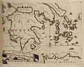
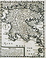
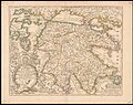
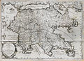
The following 80 files are in this category, out of 80 total.
-
 Map of the Peloponnese - Bordone Benedetto - 1547.jpg 800 × 795; 394 KB
-
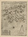 Peloponnesus N Morea - Per Claudio Ducheto - btv1b53033711p.jpg 3,156 × 4,160; 2.35 MB
-
 Peloponnesus N Morea - Per Claudio Ducheto - btv1b550000088.jpg 4,335 × 6,209; 2.49 MB
-
 Peloponnesus N Morea - Per Claudio Ducheto - btv1b55000280r.jpg 4,264 × 6,065; 2.38 MB
-
 Peloponnesus N Morea - Per Claudio Ducheto - btv1b55004588v.jpg 4,427 × 6,076; 2.56 MB
-
 Peloponnesus N Morea - Per Claudio Ducheto - btv1b55004894m.jpg 3,190 × 4,271; 1.7 MB
-
 Atlas factice des possessions de Venise et de l'Archipel - btv1b55010184g (081 of 127).jpg 3,376 × 4,369; 2.64 MB
-
 Peloponnesus Morea - Cootwijck Johannes Van - 1619.jpg 1,050 × 1,500; 682 KB
-
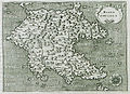 Morea Penisola - Porcacchi Tomaso - 1620.jpg 1,500 × 1,092; 1.32 MB
-
 Peloponnesus sive Morea - autore I. Laurenbergio - btv1b5962188m.jpg 6,592 × 5,544; 6.18 MB
-
 Peloponnesus, sive Morea - Auth. I. Laurenbergio - btv1b53036648q.jpg 7,513 × 6,363; 6.81 MB
-
 Map - Special Collections University of Amsterdam - OTM- HB-KZL 33.07.41.tif 7,227 × 6,336; 131.01 MB
-
 Atlas Van der Hagen-KW1049B12 095-PELOPON- NESVS sive MOREA.jpeg 5,500 × 4,647; 3.95 MB
-
-
 Map - Special Collections University of Amsterdam - OTM- HB-KZL 33.07.46.tif 7,515 × 6,257; 134.53 MB
-

-

-

-

-
 Map - Special Collections University of Amsterdam - OTM- HB-KZL 33.07.43.tif 7,239 × 6,082; 125.96 MB
-

-

-

-

-
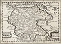
 Morea - Coronelli Vincenzo - 1686.jpg 1,500 × 1,090; 772 KB
-
 Morea - Peeters Jacob - 1686.jpg 1,500 × 864; 522 KB
-
 Morea Ins - Enderlin Jacob - 1686.jpg 892 × 1,500; 763 KB
-
 Peloponneso hoggidi Morea - Coronelli Vincenzo - 1686.jpg 2,000 × 1,485; 1.68 MB
-

-

-

-
 Frederik de Wit, Peloponnesus Hodie Moreae Regnum (FL83894205 2369963).jpg 18,525 × 12,472; 281.01 MB
-
 Map of the Peloponnese - Coronelli Vincenzo - 1687.jpg 800 × 636; 205 KB
-
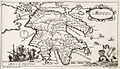
 Morea - Sandrart Jacob Von - 1686.jpg 1,195 × 1,500; 1.35 MB
-
 Morea - Sandrart Jacob Von - 1687.jpg 1,195 × 1,500; 1.35 MB
-

-
 Map of Peloponnese - Piacenza Francesco - 1688.jpg 1,658 × 1,500; 1.53 MB
-
 Morea - Coronelli Vincenzo - 1688.jpg 1,500 × 1,088; 771 KB
-
-
 Nova et accurata Moreae olim Peloponnesus dictae delineatio - Dapper Olfert - 1688.jpg 2,000 × 1,664; 1.52 MB
-

-

-

-

-
 Peloponnesus sive Morea - Dapper Olfert - 1688.jpg 2,000 × 1,667; 1.82 MB
-

-
 Peloponnneso hoggidí Morea - Coronelli Vincenzo - 1688.jpg 2,000 × 1,452; 1.38 MB
-
 Morea olim Peloponnesus - Randolph Bernard - 1689.jpg 2,000 × 1,656; 1.2 MB
-
 Atlante Veneto Volume 2 055.jpg 10,314 × 7,053; 7.41 MB
-
 La Morée et les îles de Zante, Céfalonie, Ste Maure, Cerigo.jpg 1,490 × 945; 363 KB
-
 Ca. 1696 map of Morea by Alexis-Hubert Jaillot.jpg 21,206 × 14,482; 44.32 MB
-

-
 Peloponnesus hodie Morea... - per Nicolaum Visscher - btv1b5962341w.jpg 6,720 × 5,520; 6.14 MB
-
 Morea (BM 2AA+,a.43.73).jpg 929 × 539; 157 KB
-
 Morea penisula - btv1b53194586j (2 of 3).jpg 5,082 × 4,295; 5.46 MB
-

-
 Peloponneso hoggidi Morea - Coronelli Vincenzo Maria - 1708.jpg 1,500 × 1,097; 831 KB
-

-

-
 Map - Special Collections University of Amsterdam - OTM- HB-KZL 33.07.48.tif 7,436 × 6,276; 133.52 MB
-

-
 Map of Morea in 1791 by Reilly 020.jpg 1,111 × 837; 394 KB
-
 1816 Carte de la Turquie d'Europe (Peloponnese).jpg 4,815 × 5,881; 6.86 MB
-
 Graeciae Pars Meridionalis sive Peloponnesus 01.jpg 7,057 × 4,558; 10.28 MB
-
 PéloponnèseBlouet.jpg 1,984 × 1,296; 840 KB
-
 Ancient Sparta 1839.jpg 8,542 × 5,788; 6.87 MB
-
 Sparta1839.jpg 5,288 × 4,191; 2.34 MB
-
 THIRLWALL(1845) p1.008 SOUTHERN GREECE.jpg 4,019 × 3,351; 5.69 MB
-

-
 Comparison of Plane tree leaf and Morea peninsula.jpg 1,592 × 704; 146 KB
-

-
 Peloponnes in 1879.jpg 2,000 × 1,869; 3.22 MB
-
 Ancient peloponnese.jpg 745 × 710; 226 KB
-
 Morea - Mahaffy John Pentland - 1890.jpg 1,500 × 1,375; 809 KB
-
 Pelopones ethnic.JPG 2,334 × 1,918; 929 KB
-
 Venetian map morea.PNG 2,354 × 1,776; 8.17 MB
-
 Peloponnesus et Graecia meridionalis. Wellcome L0005795.jpg 1,478 × 1,202; 760 KB
-
 Map of Greece 1903 Peloponissos.png 854 × 886; 1.98 MB
-
 Shepherd-c-014-015.jpg 1,920 × 1,539; 825 KB
-
 Achaen League Map.jpg 2,860 × 2,512; 4.52 MB


.jpg)


_-_btv1b52511195b_(45_of_85).jpg)


us_Donia_Messanensis_sculp(si)t_-_btv1b59621891.jpg)


.jpg)


.jpg)


.jpg)
.jpg)


te_Maure,_Cerigo_(et)c._-_dress%C3%A9_sur_les_M%C3%A9moires_de_Mercator,_P._Briet,_Cantelli,_Wischer_(et)c_;_par_son_tres_humble_et_tres_obeiss(an)t..._-_btv1b106786674.jpg)

.jpg)


_p1.008_SOUTHERN_GREECE.jpg)
.jpg)

.jpg)


