Category:Old maps of the history of Ukraine
Jump to navigation
Jump to search
Use the appropriate category for maps showing all or a large part of Ukraine. See subcategories for smaller areas:
| If the map shows | Category to use |
|---|---|
| Ukraine on a recently created map | Category:Maps of the Ukraine or its subcategories |
| Ukraine on a map created more than 70 years ago | Category:Old maps of Ukraine or its subcategories |
| the history of Ukraine on a recently created map | Category:Maps of the history of Ukraine or its subcategories |
| the history of Ukraine on a map created more than 70 years ago | Category:Old maps of the history of Ukraine or its subcategories |
Media in category "Old maps of the history of Ukraine"
The following 21 files are in this category, out of 21 total.
-
 Ahdufour1zoomed.png 1,351 × 909; 1.54 MB
-
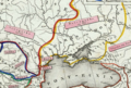
 Banduri and Lisle. Imperii Orientalis et Circumjacentium Regionum.E (Patzinacia).jpg 2,460 × 1,970; 948 KB
-

-
 Historical map of Russian, 1240-1533.gif 1,800 × 2,207; 2.01 MB
-
 Historical map of the Rus, 1054-1240.gif 1,800 × 2,207; 1.77 MB
-
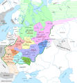
 Kievan Rus in 1237 (en).svg 1,204 × 1,306; 332 KB
-
 Kievan Rus in 1237 (PL).svg 1,200 × 1,302; 235 KB
-
 Kievan Rus in 1237 (ru).svg 1,200 × 1,302; 342 KB
-
 Kievan Rus in 1237 es.svg 1,200 × 1,302; 1.36 MB
-
 Kievan Rus in 1237 pt.svg 1,200 × 1,302; 255 KB
-
 Kievan-rus-1015-1113-(blank).png 2,193 × 2,686; 320 KB
-
 Kievan-rus-1015-1113-(de).png 2,193 × 2,686; 539 KB
-
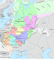
 Kievan-rus-1015-1113-(en).png 2,166 × 2,659; 440 KB
-
 Kievan-rus-1015-1113-(hu).svg 2,166 × 2,659; 608 KB
-

-
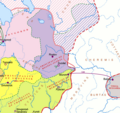 Rostov-Suzdal 1015-1113 (en).png 1,411 × 1,327; 69 KB
-
 Russian lands to 1250.jpg 2,401 × 2,018; 813 KB
-

-
 Upper Oka Principalities circa 1400 pl.jpg 3,302 × 3,104; 3.09 MB
-
 Ziemie Czernihowsko-Siewierskie w XV wieku.jpg 4,384 × 4,189; 4.47 MB
-
 Русь в 14 - 16 веках.png 2,881 × 3,561; 8.15 MB

.jpg)


.svg)
.svg)
.svg)


.png)
.png)
.svg)

.png)


.png)