Category:Old maps of the harbour of Genoa
Jump to navigation
Jump to search
Media in category "Old maps of the harbour of Genoa"
The following 15 files are in this category, out of 15 total.
-
 "Plan du Port de Genes" (22244677325).jpg 3,267 × 2,429; 1.73 MB
-

-

-
 Porto Genova 1886.png 904 × 1,386; 2.66 MB
-
 96 of '(Cook's Tourist's Handbook for Northern Italy.)' (11249816876).jpg 1,238 × 1,938; 558 KB
-
 A new chart of the Mediterranean Sea - The Port of Genoa (1797).jpg 1,979 × 2,006; 604 KB
-
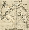
 Harbour of Genoa - Drummond Alexander - 1754.jpg 2,000 × 1,503; 1.16 MB
-
 Map of the port of Genova in Italy - Roux Joseph - 1804.jpg 1,500 × 1,024; 667 KB
-

-
 Plan du port de Gennes (sic), levé géométriquement - btv1b8440101x.jpg 8,832 × 6,798; 5.66 MB
-
 Plan du port de Gênes en Italie - par Jacques Ayrouard - btv1b530421511.jpg 6,037 × 4,725; 3.56 MB
-
 Plan du port de Gênes et environs jusqu'au château - btv1b53165233d.jpg 13,662 × 4,302; 6.6 MB
-
 Port de Gênes - btv1b53165234v.jpg 5,522 × 3,608; 2.18 MB
-
 Porto Genova 1906.png 904 × 1,386; 2.88 MB
-
 Portolano della Liguria - btv1b52511052z (37 of 65).jpg 10,063 × 7,179; 8.35 MB
.jpg)


%27_(11249816876).jpg)
.jpg)


,_lev%C3%A9_g%C3%A9om%C3%A9triquement_-_btv1b8440101x.jpg)


.jpg)