Category:Old maps of the White Sea
Jump to navigation
Jump to search
Media in category "Old maps of the White Sea"
The following 32 files are in this category, out of 32 total.
-
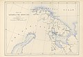
 1598 map of the Polar Regions by Willem Barentsz.jpg 13,719 × 10,160; 30.66 MB
-
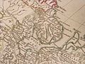
 AUBEL(1874) p439 Übersichtskarte von Lappland und Kanin.jpg 3,793 × 3,277; 5.62 MB
-
-

-
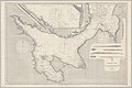
 A chart of the WHITE SEA with the River Dwina NYPL1640715.tiff 7,230 × 5,428; 112.28 MB
-

-
 A Large Chart of the White Sea - btv1b5972605b.jpg 7,256 × 5,808; 6.04 MB
-
 Admiralty Chart No 2272 White Sea Sheet IV hz207hh1961, Published 1854.jpg 20,991 × 16,525; 33.35 MB
-
 Admiralty Chart No 2274 White Sea Sheet VI mm674kx0605, Published 1854.jpg 16,744 × 20,982; 28.59 MB
-
 Admiralty Chart No 2276 White Sea Sheet VIII xd842qn6338, Published 1854.jpg 16,544 × 20,913; 30.23 MB
-
 Admiralty Chart No 2277 White Sea Sheet IX ny045bb4203, Published 1854.jpg 21,008 × 16,660; 39.89 MB
-
 Admiralty Chart No 2278 White Sea pd350by4792, Published 1854.jpg 24,791 × 16,572; 53.28 MB
-
 Barents third voyage.jpg 2,000 × 1,511; 965 KB
-
 Barentskartet, 1598 (12068020364).jpg 2,842 × 2,091; 3.85 MB
-
 Barentsz Full Map.jpg 1,000 × 742; 258 KB
-
 Bjarmaland,Carta Marina.jpg 883 × 1,090; 472 KB
-
 Forminsket utgave av Barentskartet - no-nb krt 00487.jpg 4,418 × 3,449; 3.45 MB
-

-

-
 Kaart van Zweden Kaart van Sweden Royaume de Suede (titel op object), BI-B-FM-090-87.jpg 3,576 × 2,580; 1.76 MB
-
 Kitchen-03-Russian-Lapland-2877.jpg 2,560 × 1,920; 2.03 MB
-
 Kitchen-21-Russian-Lapland-2801.jpg 2,560 × 1,920; 2.05 MB
-
 Linschoten Map of Scandinavia.jpg 1,536 × 1,316; 540 KB
-
 Linschotens nordenkart, 1601 (12067624705) (2).jpg 4,400 × 3,609; 22.96 MB
-
 Linschotens nordenkart, 1601 (12067624705).jpg 4,037 × 3,455; 22.29 MB
-
 Pontanus 1611 Arctic Map.jpg 2,852 × 2,142; 802 KB
-
 Russian-Lapland-1745.jpg 2,127 × 1,860; 599 KB
-
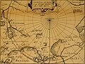
 Thornton white sea.jpg 2,906 × 2,363; 4.6 MB
-

-
 БСЭ1. Белое море 1.jpg 1,913 × 1,349; 1.21 MB
-
 БСЭ1. Белое море 2.jpg 1,927 × 1,339; 1.68 MB
-


_p439_%C3%9Cbersichtskarte_von_Lappland_und_Kanin.jpg)
.jpg)
.jpg)


.jpg)


_door_Willem_Barendsz_(titel_op_object),_NG-800.jpg)
,_BI-B-FM-090-87.jpg)


_(2).jpg)
.jpg)


_(14564523110).jpg)


.jpg)