Category:Old maps of the Tatra Mountains
Jump to navigation
Jump to search
Media in category "Old maps of the Tatra Mountains"
The following 18 files are in this category, out of 18 total.
-
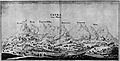
 224 of 'Die Erde. Eine allgemeine Erd- und Länderkunde, etc' (11300695614).jpg 1,668 × 1,232; 776 KB
-
 GKvME-Leutschau2.jpg 2,633 × 2,011; 1.4 MB
-
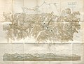
 Hale i Podhale Nowotarskie (1860).jpg 3,980 × 4,556; 5.49 MB
-
 Hohe Tatra BV035880145.jpg 10,038 × 7,876; 12.76 MB
-
 Hohe Tatra. NYPL1226428.tiff 5,411 × 4,552; 70.48 MB
-

-
 Mapa Vysokých Tatier od Važca 1793.jpg 4,571 × 2,332; 4.62 MB
-
 Orawa 1938.jpg 1,688 × 1,727; 2.32 MB
-
 PasTurystycznyPL-CS1935.jpg 1,225 × 646; 349 KB
-
 Spisz 1938.jpg 2,860 × 3,748; 2.85 MB
-
 Tatry - mapa W. Eljasza-Radzikowskiego.jpeg 8,750 × 6,723; 17.18 MB
-
 Tatry-Czarny Staw.jpg 798 × 769; 327 KB
-
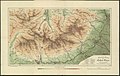
 Vysoke Tatry5. Gotha, 1865.jpg 3,278 × 2,369; 6.3 MB
-
 Wahlenbergova najstaršia samostatná mapa V. Tatier 1814.jpg 3,845 × 3,132; 7.62 MB
-

-

-
 Podrecznik geografii ojczystej 1894 (117388786) (cropped).jpg 2,808 × 2,055; 1.05 MB
-
 Touristen-Karte der Hohen Tatra - Maßstab 1-50 000 (68145061).jpg 15,115 × 9,589; 24.41 MB
.jpg)

.jpg)

._Traduit_de_l%27allemand,_avec_l%27autorisation_de_l%27auteur_et_annot%C3%A9e_sous_la_direction_de_Emm._de_Margerie._Avec_une_pr%C3%A9f._par_Marcel_Bertrand_(1897)_(14775872444).jpg)


,_Tatry_(II_i_III._7_i_8),_Szczawnica_(IV._7)_(81935499).jpg)
_(cropped).jpg)
_(cropped).jpg)
.jpg)