Category:Old maps of the Principality of Moldavia
Jump to navigation
Jump to search
Media in category "Old maps of the Principality of Moldavia"
The following 18 files are in this category, out of 18 total.
-
 117 FT6347 1770 AParis Ches le Rouge.jpg 714 × 528; 111 KB
-
 Johannes Honter-RudimentaCosmographica-Brasov1542.jpg 1,200 × 956; 326 KB
-
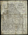
 MOLDNAPOL.jpg 3,120 × 2,256; 3.31 MB
-
 Charta poștală a Moldovei 1854.jpg 2,830 × 3,527; 1.33 MB
-
 Karta över Moldavien och Valakiet med kringliggande länder - Skoklosters slott - 97959.tif 4,715 × 3,461, 2 pages; 46.7 MB
-
 Karte-von-der-walachei-moldau-und-bessarabien.jpg 4,772 × 3,776; 2.43 MB
-
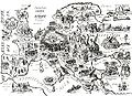
 Lăpușna Hîncești cca1700.jpg 758 × 546; 546 KB
-
 Mold.jpg 1,546 × 1,146; 450 KB
-
 Moldova Stefan cel Mare (coloured).png 1,581 × 1,167; 2.5 MB
-
 Politische Charte von Europa, 1848 Moldau.png 375 × 324; 114 KB
-
 Politische Charte von Europa, 1848.jpg 4,340 × 3,153; 3.81 MB
-
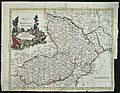 Principati di Moldavia e Vallachia - Venezia 1789.jpg 3,743 × 2,894; 1.4 MB
-
 Principati1786.jpg 6,272 × 4,704; 5.05 MB
-

-

-
 Ștefan cel Mare - Modova.jpg 1,581 × 1,167; 1.67 MB
-
 Бессарабия 1856.jpg 986 × 1,276; 621 KB
-
 МК1360.jpg 672 × 462; 86 KB


.png)


