Category:Old maps of the Paris Metro
Jump to navigation
Jump to search
Subcategories
This category has the following 4 subcategories, out of 4 total.
Media in category "Old maps of the Paris Metro"
The following 39 files are in this category, out of 39 total.
-
 Paris, chemin de fer métropolitain ; lignes en exploitation - btv1b530620268.jpg 21,565 × 16,551; 56.83 MB
-
 Le Figaro, 5 novembre 1910.jpg 465 × 702; 166 KB
-
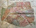
 Nouveau plan du Métropolitain et du Nord-Sud de Paris - btv1b8445653x.jpg 7,968 × 6,058; 7.73 MB
-

-

-
 Carte ancienne du métro Nord-Est de Paris.jpg 1,600 × 1,064; 887 KB
-
 Carte ancienne La plaine Saint Denis.jpg 1,600 × 1,064; 761 KB
-
 Carte ancienne La Plaine Saint Denis.jpg 1,600 × 1,064; 745 KB
-
 Carte Fort d'Aubervilliers et cimetière de Pantin. Années 50.jpg 1,600 × 1,064; 635 KB
-
 Carte-Campbell - Nouveau plan de Paris et banlieue, 1916 - Stanford Libraries.jpg 14,947 × 10,039; 44.78 MB
-
 Carte-Campbell - Nouveau plan de Paris et banlieue, 1916 - Stanford Libraries.tif 14,947 × 10,039; 143.34 MB
-

-

-
 Compagnie du chemin de fer métropolitain. Paris. Lignes en exploitation, 1908 - Gallica.jpg 21,464 × 16,536; 60.16 MB
-
 G. Dreyfus, Paris (spécialement le Métropolitain), 1912 - Gallica.jpg 5,232 × 4,006; 4.02 MB
-
 Grandes almacenes de la Samaritaine, Plano de Paris y del Metropolitano, 1914 - Gallica.jpg 6,658 × 5,040; 5.47 MB
-
 Hachette, Le Métropolitain de Paris, 1907 - Gallica.jpg 7,084 × 5,459; 7.23 MB
-
 J.-A. Théry, Plan du projet du chemin de fer métropolitain surélevé de Paris - Gallica.jpg 7,067 × 4,457; 4.63 MB
-

-
 Métro parisien état du réseau en 1939.jpeg 1,172 × 938; 594 KB
-
 Métro parisien, état du réseau en 1940.jpeg 1,169 × 933; 548 KB
-
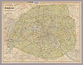
 Nouveau plan de Paris by L. Poulmaire & Garnier frères, 1909 - Stanford Libraries.jpg 18,426 × 13,737; 67.99 MB
-

-
 Paris by Plasal, 1937 - Gallica.jpg 8,936 × 6,778; 9.23 MB
-
 Paris chemins de fer métropolitain et nord-sud by A. Taride, 1922 - Stanford Libraries.jpg 20,200 × 15,800; 79.08 MB
-
 Paris chemins de fer métropolitain et nord-sud by A. Taride, 1922 - Stanford Libraries.tif 20,200 × 15,800; 304.41 MB
-
 Paris metro 192x.jpg 3,537 × 2,825; 4.04 MB
-

-
 Paris, chemin de fer métropolitain, lignes en exploitation, 1908 - Gallica.jpg 21,565 × 16,551; 59.75 MB
-
 Plan commode de Paris métropolitain et nord-sud, 1925 - Stanford Libraries.jpg 17,311 × 13,396; 70.48 MB
-
 Plan de Paris by L. Guilmin, 1913 - Gallica.jpg 6,360 × 4,832; 7.67 MB
-
 Plan de Paris Métropolitain by A. Leconte - Stanford Libraries.jpg 11,940 × 9,313; 32.31 MB
-
 Plan du métropolitain et du Nord-Sud. Maison Banno. Paris-Building - Gallica.jpg 9,080 × 6,107; 9.06 MB
-
 Taride, Chemin de fer métropolitain. Paris et banlieue, 1934 (01) - Gallica.jpg 16,434 × 13,347; 51.08 MB
-
 Taride, Chemin de fer métropolitain. Paris et banlieue, 1934 (02) - Gallica.jpg 16,477 × 13,379; 50.85 MB
-
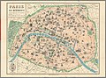
 Taride, Nouveau Plan du chemin de fer métropolitain de Paris 1905 - Gallica.jpg 9,068 × 6,751; 7.42 MB
-
 Taride, Paris Ses Monuments. Guide Pratique Du Visiteur, 1905 - David Rumsey.jpg 18,276 × 13,616; 68.71 MB
-
 The Street railway journal (1904) (14575734717).jpg 1,482 × 1,062; 194 KB
-
 The street railway review (1891) (14781035793).jpg 1,210 × 942; 84 KB


,_1912_-_Gallica.jpg)


,_1882_-_Gallica.jpg)


.jpg)


.jpg)


_-_Gallica.jpg)
_-_Gallica.jpg)


_(14575734717).jpg)
_(14781035793).jpg)