Category:Old maps of the Gulf of Saint Lawrence
Jump to navigation
Jump to search
Media in category "Old maps of the Gulf of Saint Lawrence"
The following 70 files are in this category, out of 70 total.
-
-

-

-

-
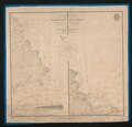
 16 of '(The St. Lawrence Pilot ... Fourth edition.)' (11152238025).jpg 2,688 × 1,879; 907 KB
-
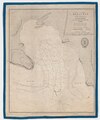
 28 of '(The St. Lawrence Pilot ... Fourth edition.)' (11229171585).jpg 2,656 × 1,704; 899 KB
-

-
 A chart of the gulf of St Laurence - btv1b59705024.jpg 7,368 × 9,176; 8.22 MB
-
 A Chart of the Streights of Belle Isle - R. Sayer - btv1b530897403 (2 of 2).jpg 5,349 × 8,088; 5.2 MB
-
-
 A new and correct chart of the gulf of St. Laurence - btv1b5970330r.jpg 12,304 × 8,000; 11.46 MB
-
 Admiralty Chart No 1134 Magdalen Islands, Published 1938.jpg 6,706 × 8,544; 3.97 MB
-
 Admiralty Chart No 1135 Bay of the Seven Islands, Published 1838.jpg 7,859 × 5,968; 7.01 MB
-
 Admiralty Chart No 1147 SW Point of Anticosti and Salt Lake Bay, Published 1838.jpg 7,815 × 6,182; 4.82 MB
-
 Admiralty Chart No 1150 East Cape and Bear Bay, Anticosti Island, Published 1838.jpg 8,217 × 7,906; 5.96 MB
-
 Admiralty Chart No 1163 Gaspe and Mal Bays, Published 1838.jpg 5,956 × 7,838; 7.49 MB
-
 Admiralty Chart No 1164 Little Mecattina Island &c, Published 1838.jpg 7,993 × 6,069; 6.15 MB
-

-

-
 Admiralty Chart No 1709 Charlottetown Harbour, Published 1845.jpg 7,971 × 6,058; 8.84 MB
-
 Admiralty Chart No 1712 Miramichi Bay and River, Published 1837.jpg 8,116 × 6,114; 5.19 MB
-

-
 Admiralty Chart No 1941 Cocagne Harbour, Published 1849.jpg 6,628 × 8,835; 5.61 MB
-
 Admiralty Chart No 1942 Bedeque Harbour, Published 1849.jpg 8,071 × 5,968; 7.65 MB
-
 Admiralty Chart No 1943 Shediac Bay and Harbour, Published 1849.jpg 6,628 × 8,835; 6.28 MB
-
 Admiralty Chart No 1977 Caribou Harbour, Published 1850.jpg 8,721 × 6,618; 5.44 MB
-
 Admiralty Chart No 1983 Richmond Bay (Malpeque Bay), Published 1850.jpg 8,432 × 12,337; 11.86 MB
-
 Admiralty Chart No 1986 Buctouche (Bouctouche) River, Published 1850.jpg 7,915 × 6,170; 7.6 MB
-
 Admiralty Chart No 1989 Pictou Harbour, Published 1850.jpg 8,721 × 6,618; 6.76 MB
-
 Admiralty Chart No 2000 Crapaud Road, Published 1850.jpg 9,807 × 7,570; 8.11 MB
-
 Admiralty Chart No 2005 Boughton or Grand River, Published 1850.jpg 7,892 × 6,058; 8.01 MB
-

-
 Admiralty Chart No 2036 Pugwash Harbour, Published 1850.jpg 6,628 × 8,712; 7.58 MB
-
 Admiralty Chart No 2055 Antigonish Harbour, Published 1851.jpg 6,706 × 8,544; 6.59 MB
-
 Admiralty Chart No 2187 Miramichi Bay, Published 1857.jpg 12,963 × 8,208; 10.4 MB
-
 Admiralty Chart No 2516 Gulf of St Lawrence and the River to Quebec, Published 1857.jpg 12,359 × 8,107; 13.66 MB
-
 Admiralty Chart No 2516 Gulf of St Lawrence and the River to Quebec, Published 1891.jpg 12,228 × 8,159; 18.92 MB
-
 Admiralty Chart No 2686 Chaleur Bay Caraquette Shippigan & Miscou Harbours, Published 1859.jpg 12,012 × 8,163; 13.82 MB
-
 Admiralty Chart No 2727 Gulf of St Lawrence Sheet 10 Cape Breton Island, Published 1860.jpg 8,112 × 11,864; 11.27 MB
-

-

-
-
-
-
-
-
-
-
-
-
-
 Gulf of St. Lawrence - Gaspé and Mal Bays (IA McGillLibrary-rbsc map bayfield-044-19152).pdf 2,977 × 3,918; 13.96 MB
-
-
-
-
-
-
-
-
-
-
-
-
-
-
-
 Prince Edward Island - Hillsborough Bay (IA McGillLibrary-rbsc map bayfield-071-19174).pdf 5,960 × 4,018; 28.46 MB
-
-
-

.jpg)


%27_(11152238025).jpg)
%27_(11229171585).jpg)
%27_(11243042095).jpg)

.jpg)


,_Published_1850.jpg)
_River,_Published_1850.jpg)


.jpg)
.jpg)