Category:Old maps of the German colonies
Jump to navigation
Jump to search
Subcategories
This category has the following 5 subcategories, out of 5 total.
W
Media in category "Old maps of the German colonies"
The following 99 files are in this category, out of 99 total.
-
 083 kiautschou-bucht-mit-tsingtau.png 1,106 × 1,776; 5.43 MB
-
 091 kamerun (1905).png 1,165 × 1,775; 1.29 MB
-
 092 togo.png 1,146 × 1,750; 1.25 MB
-
 094 deutsch-ostafrika (1905).png 1,776 × 2,236; 2.52 MB
-
 095 deutsch-sudwestafrika (1905).png 1,744 × 2,189; 2.34 MB
-
 113 kaiser-wilhelms-land-bismarck-archipel-und-samoa-inseln (1905).png 1,761 × 1,094; 1.23 MB
-
 114 karolinen-marshall-marianen-und-palau-inseln (1905).png 1,763 × 1,154; 1.33 MB
-

-

-
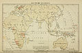
 Die Deutschen Besitzungen im Stillen Ocean 11657068.jpg 13,359 × 10,744; 45.89 MB
-

-
 1905 map of Tibet, India, Japan, and China (cropped).png 421 × 316; 94 KB
-
 Übersicht Der Deutschen Besitzungen im Stillen Ozean-Nauru.png 2,518 × 2,538; 4.49 MB
-

-

-

-

-

-

-
 Afrika (Carl Flemmings Generalkarten No. 43.).png 9,086 × 7,385; 159.7 MB
-
 Afrika Politische Uebersicht Maerz 1885.jpg 3,000 × 2,515; 4.15 MB
-
 Baumwollkarte Kamerun 1909.jpg 2,461 × 2,323; 503 KB
-
 Baumwollkarte Togo 1909.jpg 2,136 × 3,347; 777 KB
-
 Bundesarchiv Bild 137-004841, Tsingtau, Erster japanischer Plan.jpg 563 × 800; 90 KB
-
 Bundesarchiv Bild 137-004843, Tsingtau, Deutscher Plan.jpg 673 × 800; 100 KB
-
 Bundesarchiv Bild 137-009342, Karte von Tsingtau und Umgebung.jpg 800 × 671; 105 KB
-
 Dar-Es-Salam 1905.jpg 700 × 634; 412 KB
-
 Deutsch-Südwestafrika 1900.jpg 3,400 × 4,679; 3.09 MB
-
 Deutsche kolonien 1885 afrika ausschnitt.jpg 1,600 × 1,800; 601 KB
-
 Deutsche kolonien 1885.jpg 3,669 × 5,152; 2.71 MB
-
 Deutsche Schutzgebiete am Dembiah.jpg 2,416 × 2,040; 2.78 MB
-
 Deutsche Schutzgebiete.jpg 2,180 × 3,270; 1.12 MB
-
-
 Die deutsche Besitzungen in West-Afrika, 1884.png 9,081 × 7,376; 103.43 MB
-

-
 Die deutschen Schutzgebiete (1898).tif 4,440 × 3,303; 41.98 MB
-
 Die Gartenlaube (1884) b 617.jpg 3,816 × 2,643; 996 KB
-
 Die Gartenlaube (1884) b 667.jpg 721 × 1,309; 104 KB
-
 Die Gartenlaube (1886) b 111.jpg 1,158 × 974; 185 KB
-
 Die Gartenlaube (1887) b 460 1.jpg 1,696 × 980; 321 KB
-
 Dierke Schulatlas 80.Aufl.1941 Schaubild Verbreitung der Deutschen.jpg 3,968 × 2,296; 3.47 MB
-
 Eastern Shantung and Tsingtau, 1914.jpg 1,081 × 881; 277 KB
-

-
 El Imperio que Alemania ha perdido en Africa (5003881).jpg 5,000 × 3,329; 1.47 MB
-

-
 Ewe-Gebiet 1888.jpg 3,323 × 3,820; 2.37 MB
-
 Gefechte im Kiatschou-Gebiet.tif 2,787 × 1,843; 2.56 MB
-
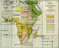 Ger claims Prof Delbruck 1917.jpg 890 × 720; 149 KB
-
 German Oceania, 1914.jpg 1,094 × 876; 224 KB
-
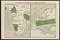
 German Pacific Colonies 1915 Map.png 2,000 × 1,213; 135 KB
-
 Germany and Possessions Before and After Armistice, 1919.jpg 1,436 × 944; 277 KB
-
 Germany clains in africa 1917.jpg 868 × 723; 141 KB
-
 Hafenanlage in der Kiautschou-Bucht.png 4,958 × 5,069; 27.75 MB
-
 Heimat- und Schulmuseum Himmelpforten, 9.jpg 4,608 × 3,456; 2.99 MB
-
 Hugo Zoeller Mahinland 1885.png 1,050 × 750; 242 KB
-
 Kaiser-Wilhelms-Land-Brockhaus b10 nr0030a hfid 5181872.jpg 5,480 × 2,805; 5.75 MB
-
 Karte der Umgebung von Daressalam (1913).tif 12,751 × 9,234; 31.75 MB
-
 Karte von Afrika mit besonderer Berücksichtigung der deutschen Kolonien (1886).png 10,747 × 11,298; 209.23 MB
-
 Karte von Afrika mit besonderer Berücksichtigung der deutschen Kolonien (1900).png 10,553 × 11,170; 193.54 MB
-
 Karte von Afrika.png 10,657 × 8,713; 177.41 MB
-
 Karte von Süd-Afrika mit besonderer Berücksichtigung der deutschen Kolonien (1900).png 10,417 × 6,015; 99.81 MB
-
 Karte West Aequatorial-Afrikas.png 6,656 × 10,894; 102.75 MB
-
 Karte zur Übersicht der Eisenbahn Duăla-Manengubagebirge.tif 10,927 × 7,860; 26.76 MB
-
 Kautschukkarte von Togo.jpg 1,304 × 2,521; 3.45 MB
-
 Kettler's Uebersichtskarte von Deutsch-Afrika - btv1b84400309.jpg 11,340 × 6,607; 8.57 MB
-
 Kolonialbesitz.png 2,057 × 1,200; 1.49 MB
-
 Kolonien Suedbrasilien.png 682 × 942; 280 KB
-
 Lome Map 1896 (Togo).jpg 1,030 × 719; 440 KB
-
 Map of German colonies in South Pacific 1913.jpg 2,048 × 982; 382 KB
-
 Map of Germany's western Pacific colonies as of 1910 (map0005325727).jpg 3,000 × 2,073; 5.97 MB
-
 Map-Deutsch-Afrika.png 2,294 × 1,456; 2.06 MB
-
 Map-Kaiser-Wilhelms-Land-und-Bismarck-Archipel.png 2,314 × 1,456; 2.14 MB
-
 Maps of German colonies in southern Brazil.jpg 442 × 775; 269 KB
-
 Marsch des Hauptteils der Schutztruppe.png 4,094 × 4,995; 39.89 MB
-
 Meyers b12 s0582a.jpg 5,319 × 2,814; 2.64 MB
-
 Meyers b17 s0499a.jpg 2,664 × 3,367; 5.92 MB
-
 Meyers b9 s0958a.jpg 3,569 × 2,309; 3.04 MB
-
 Meyers Geographischer Handatlas 1912-Tsingtau section.jpg 1,220 × 950; 1.23 MB
-
 Meyers Geographischer Handatlas 1912-Tsingtau.jpg 4,131 × 5,325; 10.33 MB
-
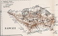 PEIP(1910) Map of Sawaii Island, Samoa.jpg 965 × 594; 304 KB
-
 Preussen-GrKF.jpg 1,266 × 601; 309 KB
-

-
 Provinz Shantung mit der Kiau-Tschou-Bucht und den Kohlenfeldern von Po-Shan-Hsiën.png 10,160 × 8,468; 108.59 MB
-
 Schantung Kiautschou (cropped).jpg 1,010 × 745; 144 KB
-
 Schantung Kiautschou.jpg 1,044 × 844; 177 KB
-
 Schutzgebiet der Marshall-Inseln-Deutscher Kolonialatlas 1897-Justus Perthes-Karte 30.jpg 10,345 × 7,761; 17.51 MB
-
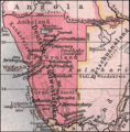 Deutsch-Sudwestafrika.png 524 × 533; 737 KB
-
 Südwestafrika 1915.jpg 1,193 × 1,351; 160 KB
-
 The graphic map of European possessions in Africa (2710779978).jpg 1,491 × 2,000; 2.69 MB
-
 The Times history of the war (1914) (14596716149).jpg 2,944 × 1,862; 1.21 MB
-
 Togo Deutsches Koloniallexikon, Verlag von Quelle & Meyer Leipzig.jpg 1,628 × 1,692; 597 KB
-
 Togo1885.jpg 1,365 × 879; 220 KB
-
 Tsingtau und Umgebung.png 4,958 × 5,788; 35.26 MB
-
 War map - Australia, China, Japan, and the South Pacific (1914).jpg 5,000 × 3,753; 13.05 MB
-
 WWI in Africa map (51244223227).jpg 3,260 × 2,328; 8.81 MB
-
 Minerva atlas 1926 (142709654).jpg 10,306 × 8,303; 116.84 MB
-
 Übersicht Der Deutschen Besitzungen im Stillen Ozean.jpg 1,019 × 1,029; 391 KB
-
 Übersichts-Karte der deutschen Ansiedlungen in der Provinz Santa-Catharina in Brasilien.png 7,475 × 5,707; 59.98 MB
-
 Übersichtskarte von DSWA.png 1,248 × 1,212; 1.56 MB

.png)

.png)
.png)
.png)
.png)
.jpg)


.jpg)
.png)

.jpg)
.jpg)
.jpg)
.jpg)
.jpg)
.jpg)
.png)


_b_617.jpg)
_b_667.jpg)
_b_111.jpg)
_b_460_1.jpg)


.jpg)


.png)
.png)

.png)


.jpg)

.jpg)


_Map_of_Sawaii_Island,_Samoa.jpg)


.jpg)


.jpg)
_(14596716149).jpg)


.jpg)
.jpg)
.jpg)


