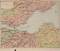
Category:Old maps of the Firth of Forth
Jump to navigation
Jump to search
Media in category "Old maps of the Firth of Forth"
The following 29 files are in this category, out of 29 total.
-
Fifae Pars Occidentalis, The West Part of Fife - btv1b53056256b (1 of 2).jpg 7,416 × 6,032; 5.31 MB
-
183 of 'The International Geography. ... Edited by H. R. Mill' (11288698354).jpg 1,220 × 765; 414 KB
-
OS Sheet 32 Edinburgh Published 1904.jpg 11,043 × 8,113; 11.47 MB
-
Admiralty Chart No 114 Survey of the Frith of Forth, by George Thomas in 1815, Published 1824.png 9,928 × 6,759; 122.17 MB
-
Admiralty Chart No 114a Firth of Forth St Abbs Head to Edinburgh, Published 1860.jpg 12,101 × 7,968; 11.82 MB
-
Admiralty Chart No 114b Firth of Forth Fisherrow to Queensferry, Published 1860.jpg 9,952 × 6,743; 22.28 MB
-
Admiralty Chart No 114c Firth of Forth Queensferry to Stirling, Published 1860.jpg 10,001 × 6,710; 24.1 MB
-
Admiralty Chart No 137 Plans in the Firth of Forth, Published 1918.jpg 16,221 × 11,088; 55.56 MB
-
Admiralty Chart No 1407 Scotland E. Coast Sheet 1 Eyemouth to the Tay, Published 1842.jpg 11,061 × 8,211; 15.48 MB
-
Admiralty Chart No 2176 North Foreland to Duncansby Head, Published 1940.jpg 11,308 × 19,692; 67.02 MB
-
Admiralty Chart No 2397a Firth of Forth to Moray Firth, Published 1863.jpg 13,587 × 11,292; 58.46 MB
-
Admiralty Chart Np 3724 Plans in the Firth of Forth, Published 1921.jpg 9,855 × 6,809; 19.75 MB
-
Methil Docks cropped from Admiralty Chart No 137, Published 1918.jpg 6,602 × 7,169; 19.41 MB
-
Ordnance Survey One-Inch Sheet 56 St Andrews and Kirkcaldy, Published 1957.jpg 8,278 × 9,952; 7.95 MB
-
Ordnance Survey One-Inch Sheet 56 St Andrews and Kirkcaldy, Published 1969.jpg 8,287 × 9,866; 28.51 MB
-
Ordnance Survey One-Inch Sheet 68 Firth of Forth, Published 1925.jpg 11,629 × 7,661; 9.4 MB
-
Ordnance Survey Quarter-inch sheet 3 The Forth, Clyde & Tay, published 1946.jpg 13,238 × 10,969; 16.2 MB
-
Ordnance Survey Quarter-inch sheet 7 Firth of Forth, published 1961.jpg 9,738 × 8,845; 10.16 MB
-
The international geography (1916) (14592970529).jpg 2,012 × 1,256; 428 KB


