Category:Old maps of the Dutch East India Company - Africa
Jump to navigation
Jump to search
Media in category "Old maps of the Dutch East India Company - Africa"
The following 12 files are in this category, out of 12 total.
-
 AMH-2544-NA Ground plan of the Duynhoop redoubt.jpg 2,400 × 2,031; 725 KB
-
 AMH-5652-KB Map of the African continent.jpg 2,400 × 1,948; 795 KB
-
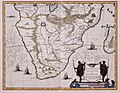 AMH-5653-KB Map of the southern part of the African continent.jpg 2,400 × 1,870; 606 KB
-
 AMH-6677-KB Two maps of the African east coast.jpg 2,400 × 1,511; 938 KB
-
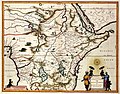
 AMH-6732-NA Map of East Africa.jpg 2,400 × 1,657; 865 KB
-
 AMH-6865-KB Map of East Africa.jpg 2,400 × 1,923; 1.1 MB
-

-
 AMH-7673-NA Map of the African coast between Cabo Negro and Cape of Good Hope.jpg 2,400 × 2,075; 890 KB
-
 AMH-7762-KB Map of a part of Africa.jpg 2,400 × 1,878; 1.05 MB
-

-
 AMH-7923-KB Map of part of the African east coast and Madagascar.jpg 2,400 × 2,115; 933 KB
-
 AMH-7925-KB Map of part of the east coast of Africa.jpg 1,798 × 2,399; 735 KB


