Category:Old maps of the Coromandel Coast
Jump to navigation
Jump to search
Subcategories
This category has the following 3 subcategories, out of 3 total.
Media in category "Old maps of the Coromandel Coast"
The following 24 files are in this category, out of 24 total.
-
-

-
 *Thomas Salmon's map of Coromandel, 1743*.jpg 1,320 × 1,500; 198 KB
-
 Coromandel Coast 1753.jpg 3,070 × 5,870; 3.62 MB
-
-

-

-

-

-

-
 Carte française de la côte de Coromandel - btv1b5905726v (1 of 2).jpg 9,936 × 8,424; 11.47 MB
-
 Carte française de la côte de Coromandel - btv1b59057293 (1 of 2).jpg 10,624 × 5,328; 7.24 MB
-
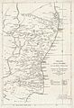
 Coromandel 1744-1780 map - A comprehensive history of India (14578124819).jpg 2,088 × 4,112; 714 KB
-

-

-

-

-
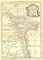
 Coromandel, A map by P. Croisey, Paris, 1770.jpg 789 × 515; 83 KB
-
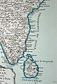
 Map of the Pearl Fishery Coast 1889.jpg 470 × 507; 59 KB
-
 Rigobert-Bonne-Atlas-de-toutes-les-parties-connues-du-globe-terrestre MG 9993.tif 5,232 × 3,534; 52.93 MB
-
-

-

-


_-_Geographicus_-_IndiaEast-lerouge-1759.jpg)


_VERY_LARGE_SCAN.jpg)
.jpg)
.jpg)
.jpg)
.jpg)


