Category:Old maps of the Cittadella di Alessandria
Jump to navigation
Jump to search
Media in category "Old maps of the Cittadella di Alessandria"
The following 10 files are in this category, out of 10 total.
-
 Bergoglio.jpg 1,816 × 1,539; 3.21 MB
-
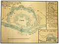
 Campo trincerato.jpg 2,431 × 2,349; 6.56 MB
-
 Giardini Cittadella di Alessandria.jpg 2,024 × 1,330; 2.5 MB
-
 Mappa fine xviii sec alessandria cropped.jpg 575 × 593; 365 KB
-
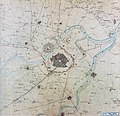
 Mappa fine xviii sec alessandria.jpg 800 × 581; 127 KB
-
 Piano di insieme.jpg 1,909 × 1,415; 3.38 MB
-
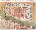
 Pianta Cittadella 1846.jpg 2,730 × 2,479; 5.96 MB
-
 Sistema idraulico.jpg 2,449 × 1,824; 5.08 MB
-
 Vittorio Amedeo II.jpg 3,334 × 4,983; 4.96 MB
-


.jpg)