Category:Old maps of the Arctic Ocean
Jump to navigation
Jump to search
Subcategories
This category has only the following subcategory.
O
Media in category "Old maps of the Arctic Ocean"
The following 25 files are in this category, out of 25 total.
-
 1598 map of the Polar Regions by Willem Barentsz.jpg 13,719 × 10,160; 30.66 MB
-
-
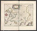
 Atlante Veneto Volume 1 092.jpg 9,882 × 6,596; 7.04 MB
-
 Atlante Veneto Volume 1 094.jpg 9,814 × 6,578; 4.29 MB
-

-
-

-

-

-

-
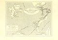
 Barents third voyage.jpg 2,000 × 1,511; 965 KB
-
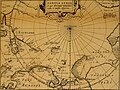
 Barentskartet, 1598 (12068020364).jpg 2,842 × 2,091; 3.85 MB
-
 Barentsz Full Map.jpg 1,000 × 742; 258 KB
-
 Carpenter Porcupine 1870 Plate 7 proceedingsofroy1818roya 0537.jpg 3,766 × 3,381; 1.99 MB
-
 Carte Stefansson Torfaeus Sigrud Herjolsnes Vinland.jpg 487 × 466; 69 KB
-
 Forminsket utgave av Barentskartet - no-nb krt 00487.jpg 4,418 × 3,449; 3.45 MB
-

-

-
 Mapa de las tierra hiperboreas-sigurdur stefansson-1579.jpg 600 × 694; 116 KB
-
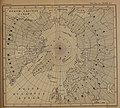
 Pontanus 1611 Arctic Map.jpg 2,852 × 2,142; 802 KB
-
 Skálholt Map (cropped).jpg 500 × 583; 140 KB
-
 Skálholt Map.jpg 830 × 1,023; 191 KB
-
 Skálholt-Karte, einschließlich Legende.jpg 1,619 × 2,041; 637 KB
-
 Skálholt-Karte.png 341 × 398; 290 KB
-
 Taakeheim ill 98.png 580 × 667; 594 KB

.1.(2).jpg)


_Theilen_und_einem_wisenschaftlichen_Anhang_..._Mit_..._Vorwort_von_Dr._A._Petermann%27_(11096595063).jpg)
.jpg)
.jpg)
.jpg)
.jpg)
.jpg)

.jpg)


_door_Willem_Barendsz_(titel_op_object),_NG-800.jpg)


.jpg)


