Category:Old maps of the Andaman Islands
Jump to navigation
Jump to search
Subcategories
This category has only the following subcategory.
Media in category "Old maps of the Andaman Islands"
The following 11 files are in this category, out of 11 total.
-

-
 Admiralty Chart No 2986 Port Cornwallis, Published 1897, Large Corrections 1965.jpg 8,325 × 11,225; 28.68 MB
-
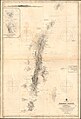 Admiralty Chart No 825 Andaman Islands, Published 1891.jpg 10,878 × 16,031; 46.86 MB
-

-
 Admiralty Chart No 837 North East Harbour on the Grand Andaman Island, Published 1795.jpg 6,178 × 4,168; 2.16 MB
-
 Blair 1799 Sketch of Andaman Islands.jpg 3,307 × 4,677; 1.2 MB
-
 Chart of Part of Great Andaman Island Blair 1789 01.jpg 7,902 × 9,870; 6.38 MB
-
 Chart of the Andaman Islands Blair 1793 02.jpg 12,370 × 10,578; 14.94 MB
-
 Chart of the Andaman Islands Blair 1793 03.jpg 12,332 × 10,506; 12.75 MB
-
 Chart of the Andaman Islands Blair 1793 04.jpg 13,232 × 10,334; 12.5 MB
-
 Java, Sumatra and the other islands of the Dutch East Indies (1914) (14577083058).jpg 1,984 × 2,264; 817 KB
.jpg)


_(14577083058).jpg)