Category:Old maps of provinces of France
Jump to navigation
Jump to search
Subcategories
This category has the following 3 subcategories, out of 3 total.
C
- Old maps of Comminges (22 F)
N
Media in category "Old maps of provinces of France"
The following 74 files are in this category, out of 74 total.
-
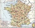
 France anciennes provinces 1789.jpg 1,147 × 916; 343 KB
-
 Medieval Ecclesiastical Divisions of France.jpg 3,010 × 3,890; 3.55 MB
-
 Agenais generalite Bdx.jpg 1,016 × 1,145; 117 KB
-
 Angoumois.jpg 1,534 × 1,028; 1.38 MB
-
 Anjou - Province.jpg 1,659 × 1,159; 1.48 MB
-
 Anjou-Touraine.JPG 870 × 508; 116 KB
-
 Armanhac sXV.jpg 1,280 × 690; 446 KB
-
 1576 Ortellius ARTOIS.jpg 960 × 1,323; 1.07 MB
-
 Artois (province).jpg 2,369 × 1,258; 1.56 MB
-
 Aunis.jpg 1,138 × 1,011; 836 KB
-
 Auvergne - Province.jpg 2,884 × 1,472; 1.6 MB
-
 Bourbonnais (province).jpg 3,000 × 1,500; 1.63 MB
-
 Bourgogne - Burgundy.jpg 1,757 × 2,066; 2.12 MB
-
 Bretagne - Brittany.jpg 2,554 × 2,160; 1.59 MB
-
 Brockhaus and Efron Encyclopedic Dictionary b72 582-2.jpg 2,705 × 2,127; 1.72 MB
-
 Béarn.jpg 1,465 × 1,050; 846 KB
-
 Carte berry.jpg 1,081 × 1,000; 172 KB
-

-
-
 Carte du Berry 1566.jpg 4,061 × 3,947; 5.88 MB
-
 Carte du Saumurois.JPG 588 × 622; 85 KB
-
 Carte du Vexin Beauvoisis et Hurepoix 1634.jpg 8,789 × 6,592; 34.74 MB
-
 Carte du Vexin Beauvoisis et Hurepoix 1634.tif 8,789 × 6,592; 165.79 MB
-
 Cartecassinigrasse.jpg 992 × 662; 321 KB
-
 Champagne - Province.jpg 2,700 × 2,250; 1.7 MB
-
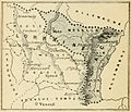
 Comtat Venaissin.jpg 3,116 × 1,542; 1.69 MB
-
 Comté de Foix.jpg 2,093 × 965; 1.52 MB
-
 Dauphiné-.jpg 2,284 × 1,881; 1.63 MB
-
 Diocèses de Nantes et d'Angers.JPG 804 × 607; 454 KB
-
 English conquests in france 1382.jpg 885 × 1,212; 402 KB
-
 Flandre française.jpg 2,208 × 1,200; 2.22 MB
-
 France departments 1791 (1).jpg 1,635 × 1,303; 895 KB
-
 Franche-Comté.jpg 2,524 × 1,681; 1.48 MB
-
 French departments 1791.png 1,112 × 899; 2.02 MB
-
 G. Bruno - Le Tour de la France par deux enfants p016.jpg 1,248 × 1,068; 278 KB
-
 G. Bruno - Le Tour de la France par deux enfants p077.jpg 856 × 1,208; 179 KB
-
 G. Bruno - Le Tour de la France par deux enfants p093.jpg 752 × 1,060; 203 KB
-
 G. Bruno - Le Tour de la France par deux enfants p104.jpg 844 × 1,184; 178 KB
-
 G. Bruno - Le Tour de la France par deux enfants p118.jpg 1,024 × 848; 173 KB
-
 G. Bruno - Le Tour de la France par deux enfants p124.jpg 1,180 × 832; 205 KB
-
 G. Bruno - Le Tour de la France par deux enfants p151.jpg 868 × 852; 146 KB
-
 G. Bruno - Le Tour de la France par deux enfants p162.jpg 876 × 1,188; 284 KB
-
 G. Bruno - Le Tour de la France par deux enfants p180h.jpg 1,008 × 860; 240 KB
-
 G. Bruno - Le Tour de la France par deux enfants p199.jpg 860 × 1,196; 259 KB
-
 G. Bruno - Le Tour de la France par deux enfants p213h.jpg 1,196 × 852; 221 KB
-
 G. Bruno - Le Tour de la France par deux enfants p224.jpg 832 × 1,188; 215 KB
-
 G. Bruno - Le Tour de la France par deux enfants p237.jpg 1,176 × 848; 232 KB
-
 G. Bruno - Le Tour de la France par deux enfants p265h.jpg 1,032 × 828; 153 KB
-
 G. Bruno - Le Tour de la France par deux enfants p272.jpg 848 × 1,204; 195 KB
-
 G. Bruno - Le Tour de la France par deux enfants p278.jpg 852 × 1,192; 166 KB
-
 Gascogne - Gascony.jpg 3,000 × 1,496; 1.95 MB
-
 Guyenne.jpg 2,383 × 1,650; 1.8 MB
-
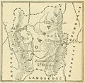
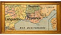
 Languedoc.jpg 3,450 × 2,400; 2.07 MB
-
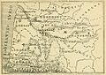
 Limousin.jpg 1,672 × 1,348; 1.28 MB
-
 Lorraine - Province.jpg 2,793 × 1,866; 1.91 MB
-
 Lyonnais - Province.jpg 2,400 × 1,350; 1.11 MB
-
 Maine - Province.jpg 1,725 × 1,634; 1.43 MB
-
 Marche - Province.jpg 1,694 × 1,300; 1.59 MB
-
 Nivernais (province).jpg 4,200 × 2,700; 2.11 MB
-
 Nivernois-1840, T1, p11.png 2,595 × 3,460; 4.41 MB
-
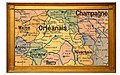 Orléanais.jpg 2,400 × 1,500; 1.77 MB
-
 Perche - Province.jpg 1,950 × 1,050; 1.48 MB
-
 Picardie - Province.jpg 1,956 × 1,640; 1.87 MB
-
 Plan La Rochelle et environs, 1773, Nicolas Chalmandrier, BNF Gallica.jpg 8,564 × 6,128; 43.38 MB
-
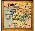
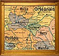
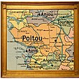 Poitou - Province.jpg 1,421 × 1,510; 1.92 MB
-
 Provence - Province.jpg 3,600 × 2,100; 1.9 MB
-
 Provincesgeneralitesfrance.jpg 632 × 575; 441 KB
-
 Roussillon (province).jpg 1,800 × 1,500; 1.24 MB
-
 Saintonge.jpg 1,149 × 1,021; 1.15 MB
-
 Seneschaussee-de-Bordeaux-1700.jpg 1,532 × 1,054; 531 KB
-

-
 Touraine.jpg 1,636 × 1,570; 1.42 MB
-
 Vidal-Lablache n°9 - Provinces en 1789.jpg 6,918 × 5,806; 48.15 MB
-
 Île-de-France - province.jpg 2,665 × 1,181; 1.7 MB


.jpg)


.jpg)


_1.jpg)
_2.jpg)


.jpg)


.jpg)


.jpg)


.jpg)


