Category:Old maps of local government areas in New South Wales
Jump to navigation
Jump to search
Media in category "Old maps of local government areas in New South Wales"
The following 30 files are in this category, out of 30 total.
-
 Australia-Map-NSW-LGA-ArmidaleDumaresq.png 720 × 593; 16 KB
-
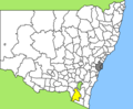
 Australia-Map-NSW-LGA-Bombala.png 720 × 593; 16 KB
-
 Australia-Map-NSW-LGA-Boorowa.png 720 × 593; 16 KB
-
 Australia-Map-NSW-LGA-Conargo.png 720 × 593; 16 KB
-
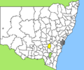
 Australia-Map-NSW-LGA-Cooma-Monaro.png 720 × 593; 16 KB
-
 Australia-Map-NSW-LGA-Cootamundra.png 720 × 593; 16 KB
-
 Australia-Map-NSW-LGA-Corowa.png 720 × 593; 16 KB
-
 Australia-Map-NSW-LGA-Deniliquin.png 720 × 593; 16 KB
-
 Australia-Map-NSW-LGA-Dubbo.png 720 × 593; 16 KB
-
 Australia-Map-NSW-LGA-Gloucester.png 720 × 593; 16 KB
-
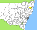
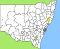
 Australia-Map-NSW-LGA-Gosford.png 720 × 593; 16 KB
-
 Australia-Map-NSW-LGA-GreaterTaree.png 720 × 593; 16 KB
-
 Australia-Map-NSW-LGA-GreatLakes.png 720 × 593; 16 KB
-
 Australia-Map-NSW-LGA-Gundagai.png 720 × 593; 16 KB
-
 Australia-Map-NSW-LGA-Guyra.png 720 × 593; 16 KB
-
 Australia-Map-NSW-LGA-Harden.png 720 × 593; 16 KB
-
 Australia-Map-NSW-LGA-Jerilderie.png 720 × 593; 16 KB
-
 Australia-Map-NSW-LGA-Murray.png 720 × 593; 16 KB
-
 Australia-Map-NSW-LGA-Murrumbidgee.png 720 × 593; 16 KB
-
 Australia-Map-NSW-LGA-Palerang.png 720 × 593; 16 KB
-
 Australia-Map-NSW-LGA-Queanbeyan.png 720 × 593; 16 KB
-
 Australia-Map-NSW-LGA-Regions.png 720 × 593; 17 KB
-
 Australia-Map-NSW-LGA-SnowyRiver.png 720 × 593; 16 KB
-
 Australia-Map-NSW-LGA-Tumbarumba.png 720 × 593; 16 KB
-
 Australia-Map-NSW-LGA-Tumut.png 720 × 593; 16 KB
-
 Australia-Map-NSW-LGA-Urana.png 720 × 593; 16 KB
-
 Australia-Map-NSW-LGA-Wakool.png 720 × 593; 16 KB
-
 Australia-Map-NSW-LGA-Wellington.png 720 × 593; 16 KB
-
 Australia-Map-NSW-LGA-Wyong.png 720 × 593; 16 KB
-
 Australia-Map-NSW-LGA-Young.png 720 × 593; 16 KB


