Category:Old maps of islands
Jump to navigation
Jump to search
Subcategories
This category has the following 4 subcategories, out of 4 total.
Media in category "Old maps of islands"
The following 5 files are in this category, out of 5 total.
-

-
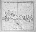
 Anjediva isle map.jpg 366 × 210; 22 KB
-
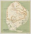 TB(1895) p595 Map of Kolguev Island.jpg 2,159 × 2,335; 2.27 MB
-
 Zilt 1788.jpg 940 × 844; 296 KB
-
 ValcourIslandMap1776Overview.jpg 837 × 529; 213 KB


_p595_Map_of_Kolguev_Island.jpg)

