Category:Old maps of former arrondissements of Paris
Jump to navigation
Jump to search
Subcategories
This category has the following 6 subcategories, out of 6 total.
P
Media in category "Old maps of former arrondissements of Paris"
The following 37 files are in this category, out of 37 total.
-
 1797 Jean Map of Paris and the Faubourgs, France - Geographicus - Paris-jean-1797.jpg 6,000 × 3,938; 9.78 MB
-

-
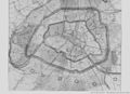 Documents relatifs à l'extension des limites de Paris - p130.jpg 1,448 × 1,054; 195 KB
-

-

-

-

-

-
-
 Auguste Logerot, Nouveau plan itinéraire de la ville de Paris, 1841 - e-rara.jpg 6,630 × 4,760; 36.91 MB
-
-
 Esnault, Nouveau Plan Routier De La Ville De Paris Et De Ses Faubourgs, 1811 - David Rumsey.jpg 26,736 × 16,582; 162.19 MB
-

-

-

-

-
 Narat, Plan de Paris divisé en 12 arrondissements indiquant tous les changements, 1843 - David Rumsey.jpg 18,464 × 12,936; 104.01 MB
-
 Narat, Plan de Paris divisé en 12 arrondissements indiquant tous les changements, 1843 - David Rumsey.png 18,464 × 12,936; 359.47 MB
-
 Nouveau plan de la ville de Paris divisé en douze arrondissements, 1828.jpg 18,466 × 14,478; 88.35 MB
-

-
 Nouveau plan de Paris divisé en XII arrondissemens ou mairies, 1823 - Paris Musées.jpg 10,152 × 6,760; 61.43 MB
-
 Nouveau plan routier de la ville & faubourgs de Paris, ca. 1800 - Stanford Libraries.jpg 16,917 × 10,379; 32.02 MB
-
 Nouveau plan routier de la ville & faubourgs de Paris, ca. 1800 - Stanford Libraries.tif 16,917 × 10,379; 167.45 MB
-

-
 Paris divisé en XII arrondissemens, 1841 - Gallica.jpg 5,374 × 3,492; 4.13 MB
-
 Paris, divisé en 12 arrondissemens et 48 quartiers by A. Toussaint, 1841 - Stanford Libraries.jpg 17,789 × 11,759; 37.07 MB
-
 Paris, divisé en 12 arrondissemens et 48 quartiers by A. Toussaint, 1841 - Stanford Libraries.tif 17,789 × 11,759; 199.52 MB
-
 Petit atlas pittoresque 01 - Tableau des arrondissemens et des quartiers - BHVP.jpg 4,311 × 3,296; 2.02 MB
-

-

-
 Plan de la ville et faubourg de Paris divisé en 12 municipalités, 1798 - Gallica.jpg 10,722 × 7,993; 16.24 MB
-

-
 Plan de Paris divisé en 12 mairies, Subdivisée chacune en quatre Patries, 1811 - Paris Musées.jpg 18,682 × 13,185; 190.73 MB
-
 Plan de Paris en 1797, division administrative - Paris Musées.jpg 7,648 × 6,064; 26.29 MB
-
 Plan géométral de Paris et de ses fauxbourgs - Norman B. Leventhal Map Center.tif 7,434 × 5,188; 110.37 MB
-
 Plan Géométral De Paris Et De Ses Fauxbourgs.jpg 11,941 × 8,264; 22.8 MB
-
 Xavier Girard, Plan geometral de la ville de Paris, 1845.jpg 31,348 × 23,834; 221.59 MB


