Category:Old maps of cities in Virginia
Jump to navigation
Jump to search
States of the United States: Alabama · Alaska · Arizona · Arkansas · California · Colorado · Connecticut · Delaware · Florida · Georgia · Hawaii · Idaho · Illinois · Indiana · Iowa · Kansas · Kentucky · Louisiana · Maine · Maryland · Massachusetts · Michigan · Minnesota · Mississippi · Missouri · Montana · Nebraska · Nevada · New Hampshire · New Jersey · New Mexico · New York · North Carolina · North Dakota · Ohio · Oklahoma · Oregon · Pennsylvania · Rhode Island · South Carolina · South Dakota · Tennessee · Texas · Utah · Vermont · Virginia · Washington · West Virginia · Wisconsin · Wyoming
Subcategories
This category has only the following subcategory.
S
Media in category "Old maps of cities in Virginia"
The following 3 files are in this category, out of 3 total.
-
 23 Part of Marshall Ward Richmond and Lower District Henrico Co. (16786917031).jpg 2,339 × 1,594; 829 KB
-
 Alexandria Bird's Eye View 1863.jpg 7,624 × 5,112; 23.5 MB
-
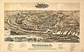 Waynesboroin1891.jpg 2,684 × 1,676; 1.2 MB
.jpg)

