Category:Old maps of cities in Morocco
Appearance
Countries of Africa: Algeria · Cape Verde · Egypt‡ · Mali · Morocco · Senegal · South Africa · Tunisia
‡: partly located in Africa
‡: partly located in Africa
Subcategories
This category has the following 6 subcategories, out of 6 total.
Media in category "Old maps of cities in Morocco"
The following 13 files are in this category, out of 13 total.
-
ROSSER(1869) p0562 MOGADOR.jpg 2,842 × 2,863; 3.44 MB
-
IMRAY(1884) p0513 MOGADOR HARBOUR.jpg 3,641 × 2,707; 5.16 MB
-
Admiralty Chart No 2078 Plans on the North West Coast of Africa, Published 1954, New Edition 1960.jpg 16,243 × 11,101; 56.49 MB
-
Map of Agadir 1887 (11175491214).jpg 2,240 × 1,330; 335 KB
-
Mazagão desenhada por Inácio António da Silva, em 1802.jpg 5,660 × 3,474; 4.97 MB
-
Plan d'Agadir en 1885.jpg 2,960 × 1,930; 2.07 MB
-
Plan d'Oudjda au 10 000e 1920.jpg 1,283 × 1,054; 397 KB
-
Plano y perfil del Puerto de Mogodor. LOC 92684153.jpg 8,337 × 6,540; 5.03 MB
-
Plano y perfil del Puerto de Mogodor. LOC 92684153.tif 8,337 × 6,540; 155.99 MB
-
Ville de Mazagan 1922.jpg 12,144 × 7,941; 44.96 MB
-
خريطة فضالة 1942.jpg 4,369 × 4,779; 3.59 MB
-
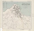
خريطة مازاغان 1942.jpg 4,757 × 4,362; 4.55 MB


