Category:Old maps of cities in Mexico
Jump to navigation
Jump to search
Use the appropriate category for maps showing all or a large part of city in Mexico. See subcategories for smaller areas:
| If the map shows | Category to use |
|---|---|
| city in Mexico on a recently created map | Category:Maps of cities in Mexico or its subcategories |
| city in Mexico on a map created more than 70 years ago | Category:Old maps of cities in Mexico or its subcategories |
| the history of city in Mexico on a recently created map | Category:Maps of the history of cities in Mexico or its subcategories |
| the history of city in Mexico on a map created more than 70 years ago | Category:Old maps of the history of cities in Mexico or its subcategories |
Subcategories
This category has the following 6 subcategories, out of 6 total.
Media in category "Old maps of cities in Mexico"
The following 11 files are in this category, out of 11 total.
-
 1632 Cardona Descripcion Indias (117).jpg 3,184 × 2,165; 1.56 MB
-
 1632 Cardona Descripcion Indias (129).jpg 3,184 × 2,165; 579 KB
-
 Cholula, Tlaxcala, Mexico WDL502.png 1,409 × 1,024; 2.64 MB
-
 Culhuacán, Mexico WDL457.png 1,024 × 1,360; 2.5 MB
-
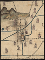
 Map of San juan bautista (1884).jpg 4,257 × 3,069; 6.48 MB
-
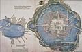 Map of Tenochtitlan, 1524.jpg 3,029 × 1,931; 4.99 MB
-
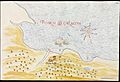
 His-map-oaxaca.jpg 250 × 208; 24 KB
-
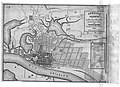
 Plan of Monterrey Mexico 1919.GIF 1,103 × 933; 404 KB
-
 Plans of Inland Towns -3-.jpg 4,017 × 2,819; 1.19 MB
-
 Van Beecq - Tenochtitlan.jpeg 733 × 512; 192 KB
-
 Van Beecq - View of Tenochtitlan.jpeg 768 × 316; 111 KB
.jpg)
.jpg)


.jpg)


