Category:Old maps of cities in Guyana
Jump to navigation
Jump to search
Use the appropriate category for maps showing all or a large part of cities in Guyana. See subcategories for smaller areas:
| If the map shows | Category to use |
|---|---|
| cities in Guyana on a recently created map | Category:Maps of cities in Guyana or its subcategories |
| cities in Guyana on a map created more than 70 years ago | Category:Old maps of cities in Guyana or its subcategories |
| the history of cities in Guyana on a recently created map | Category:Maps of the history of cities in Guyana or its subcategories |
| the history of cities in Guyana on a map created more than 70 years ago | Category:Old maps of the history of cities in Guyana or its subcategories |
Media in category "Old maps of cities in Guyana"
The following 3 files are in this category, out of 3 total.
-
 Admiralty Chart No 533 Georgetown and Mouths of Demerara & Essequibo Rivers, Published 1872.jpg 12,195 × 8,214; 27.9 MB
-
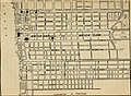
 Plate 13 Plan of Demerara.jpg 1,536 × 990; 365 KB
-


_(14595891380).jpg)