Category:Old maps of central Indonesia
Jump to navigation
Jump to search
| NO WIKIDATA ID FOUND! Search for Old maps of central Indonesia on Wikidata | |
| Upload media |
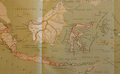
Maps showing not whole, but only central part of Indonesia, it may include (but not focusing on) Kalimantan, Java, and Sulawesi to some extent. It may not include Sumatra, the Moluccas, and the Western Papua.

Subcategories
This category has the following 3 subcategories, out of 3 total.
J
S
~
Media in category "Old maps of central Indonesia"
The following 4 files are in this category, out of 4 total.
-
 Admiralty Chart No 2637 Strait of Makassar, Published 1885.jpg 10,920 × 16,073; 51.48 MB
-
 Admiralty Chart No 2662 Ports in Makassar Strait, Published 1859, Large Corrections 1903.jpg 10,893 × 16,406; 21.85 MB
-

-
 Molucca3.png 1,380 × 852; 1.64 MB


