Category:Old maps of Ypsilanti, Michigan
Jump to navigation
Jump to search
Subcategories
This category has only the following subcategory.
Media in category "Old maps of Ypsilanti, Michigan"
The following 5 files are in this category, out of 5 total.
-
 Map of Washtenaw County, Michigan - from actual surveys LOC 2012593013.jpg 14,396 × 13,296; 29.1 MB
-
 MSNC map 1918.PNG 400 × 270; 190 KB
-

-

-
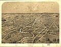 Ypsilanti, Washtenaw Co., Michigan. LOC 73693449.jpg 8,896 × 6,928; 11.51 MB


