Category:Old maps of Worcester
Jump to navigation
Jump to search
Subcategories
This category has only the following subcategory.
Media in category "Old maps of Worcester"
The following 17 files are in this category, out of 17 total.
-
 Worcester 1610 map trimmed.jpg 775 × 596; 247 KB
-
 Worcester, 1610 map.jpg 775 × 726; 293 KB
-
 Worcester Nash Map.jpg 933 × 673; 389 KB
-

-

-
 Worcester (BM 1868,0822.5954).jpg 2,135 × 1,752; 1,009 KB
-
 Worcester in 1806. Engraving by J.Roper from a drawing by G.Cole.jpg 626 × 769; 141 KB
-
 Ordnance Survey Drawings - Worcester, Worcestershire (OSD 215).jpg 4,000 × 2,966; 4.1 MB
-
 EW(1884) p.252 - Worcester (left) - A + C Black (pub).jpg 1,225 × 1,902; 432 KB
-
 EW(1884) p.253 - Worcester (right) - A + C Black (pub).jpg 1,277 × 1,902; 585 KB
-
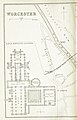
 EB9 Worcester (city) - plan.jpg 820 × 996; 323 KB
-

-
 Abbotswood, Malvern, Stroke Prior & Worcester RJD 81.jpg 1,788 × 2,868; 632 KB
-
 Worcester ANGS Water Drainage Map.pdf 1,275 × 1,650; 242 KB
-
 Worcester Castle 1610.jpg 588 × 369; 67 KB
-
 Worcester Castle 1651.jpg 366 × 351; 39 KB
-
 Worcester Nash Map crop Commandery location.jpg 422 × 673; 225 KB


.jpg)
.jpg)
.jpg)

.jpg)
_p.252_-_Worcester_(left)_-_A_%2B_C_Black_(pub).jpg)
_p.253_-_Worcester_(right)_-_A_%2B_C_Black_(pub).jpg)
_-_plan.jpg)
%27_(11052937626).jpg)


