Category:Old maps of Woerden
Jump to navigation
Jump to search
Media in category "Old maps of Woerden"
The following 19 files are in this category, out of 19 total.
-

-
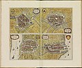 Atlas de Wit 1698-pl032-Woerden-KB PPN 145205088.jpg 2,000 × 1,655; 1.98 MB
-
 Fort kruipin en fort oranje.jpg 400 × 448; 128 KB
-
 Oude kaart van Woerden met kruipin.jpg 756 × 602; 153 KB
-
-
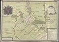
 Plattegrond door J. van Deventer - Woerden - 20215846 - RCE.jpg 1,200 × 807; 222 KB
-
 Plattegrond Oudewater Oudewater (titel op object), RP-P-AO-10-63-3.jpg 4,674 × 3,828; 3.24 MB
-

-
 Plattegrond van Woerden Woerden (titel op object), RP-P-AO-10-58A-1.jpg 2,436 × 1,956; 1.22 MB
-
 Plattegrond van Woerden Woerden (titel op object), RP-P-AO-10-59.jpg 2,868 × 2,272; 1.4 MB
-
 Plattegrond van Woerden Woerden (titel op object), RP-P-AO-10-59A-1.jpg 2,804 × 1,986; 1.07 MB
-
 Plattegrond van Woerden Woerden (titel op object), RP-P-AO-10-59A-2.jpg 4,426 × 3,038; 2.36 MB
-

-
 Plattegrond van Woerden, ca. 1701-1715 Woerden (titel op object), RP-T-00-3661A-4.jpg 5,308 × 4,132; 2.24 MB
-

-

-
 Vestingplattegrond van Woerden Woerden (titel op object), RP-P-AO-10-58A-2.jpg 1,738 × 1,632; 500 KB
-
 Woerden kaart Vingbooms Groot Waterschap 1670.jpg 1,248 × 836; 630 KB
-
 Woerden, Gemeenteatlas van Nederland.jpg 2,625 × 2,086; 1.1 MB


,_RP-P-AO-10-63-3.jpg)

,_RP-P-AO-10-58A-1.jpg)
,_RP-P-AO-10-59.jpg)
,_RP-P-AO-10-59A-1.jpg)
,_RP-P-AO-10-59A-2.jpg)
_Les_Forces_de_l%27Europe,_Asie,_Afrique_et_Amerique_Comme_aussi_les_Cartes_des_C%C3%B4tes_de_France_et_d%27Espagne_(serietitel_op_object),_RP-P-OB-83.036-75.jpg)
,_RP-T-00-3661A-4.jpg)
_Afbeeldinghe_van_eenighe_Steden_ende_Fortifica,_RP-P-1907-2079.jpg)

,_RP-P-AO-10-58A-2.jpg)

