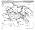
Category:Old maps of Weesp
Jump to navigation
Jump to search
Media in category "Old maps of Weesp"
The following 12 files are in this category, out of 12 total.
-
Weesp 1867.PNG 1,500 × 1,277; 110 KB
-
Weesperkarspel 1869.PNG 1,500 × 1,290; 181 KB
-
Atlas de Wit 1698-pl033-Weesp-KB PPN 145205088.jpg 2,000 × 1,672; 2.04 MB
-
MapFortsWessp.JPG 2,048 × 1,360; 734 KB
-
Plattegrond - Weesp - 20252032 - RCE.jpg 1,200 × 950; 276 KB
-
Plattegrond - Weesp - 20252033 - RCE.jpg 1,200 × 959; 230 KB
-
Plattegrond plan van de Fortificatie - Weesp - 20252031 - RCE.jpg 1,200 × 867; 273 KB
-
Plattegrond van Blaeu - Weesp - 20252030 - RCE.jpg 1,200 × 879; 376 KB
-
Plattegrond van J. van Deventer - Weesp - 20252029 - RCE.jpg 868 × 1,200; 325 KB
-
Weesp (Atlas van Loon).jpg 2,332 × 1,560; 1.67 MB
-
Weesp topo.jpg 300 × 290; 27 KB


