Category:Old maps of Wachtebeke
Jump to navigation
Jump to search
Media in category "Old maps of Wachtebeke"
The following 4 files are in this category, out of 4 total.
-
 Wachtebeke, Belgium, Ferraris Map, 1775.jpg 1,680 × 1,050; 515 KB
-
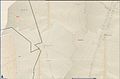 Kloosterbos, Belgium, Atlas der buurtwegen.jpg 1,599 × 1,048; 138 KB
-
 Kloosterbos, Ferraris, 1777.jpg 1,280 × 1,024; 358 KB
-
 Puyenbroeck, belgium on ferraris map.jpg 2,247 × 1,996; 724 KB


