Category:Old maps of Vårby gård
Jump to navigation
Jump to search
Media in category "Old maps of Vårby gård"
The following 24 files are in this category, out of 24 total.
-
 General Carta Vårby 1703 del färg.jpg 1,552 × 1,046; 546 KB
-
 General Carta Vårby 1703 del godset.jpg 904 × 530; 142 KB
-
 General Carta Vårby 1703 del Nytorp.jpg 918 × 556; 221 KB
-
 General Carta Vårby 1703 Haga.jpg 438 × 396; 79 KB
-
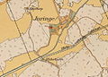
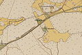
 General Carta Vårby 1703 Juringe.jpg 940 × 666; 278 KB
-
 General Carta Vårby 1703 Måns Kier.jpg 385 × 344; 61 KB
-
 General Carta Vårby 1703 Måns Kierr text "Exlpicatio Numer".jpg 352 × 154; 17 KB
-
 General Carta Vårby 1703 Smesta.jpg 628 × 405; 120 KB
-
 General Carta Vårby 1703.jpg 3,394 × 3,354; 1.9 MB
-
 Juringe gård karta 1920.jpg 651 × 466; 112 KB
-
 Segeltorp karta 1846.jpg 1,056 × 1,200; 464 KB
-
 Vårby gård 1912.jpg 835 × 509; 183 KB
-
 Vårby gård karta 1840.jpg 1,372 × 1,440; 862 KB
-
 Vårby gård karta 1908.jpg 1,587 × 1,050; 541 KB
-
 Vårby gård karta 1908x.jpg 1,486 × 994; 734 KB
-
 Vårby gård med omgivning 1908.jpg 1,584 × 2,188; 1.29 MB
-
 Vårby gård Vårby skola 1920.jpg 955 × 647; 166 KB
-
 Vårby karta 1861.jpg 902 × 616; 382 KB
-
 Vårby karta 1901.jpg 1,548 × 1,840; 605 KB
-
 Vårby Sadelmakaretorp Lindvreten.jpg 1,792 × 1,108; 386 KB
-
 Wårby karta 1703.jpg 1,384 × 1,266; 672 KB
-
 Wårby karta 1703a.jpg 2,070 × 1,280; 829 KB
-
 Wårby karta 1703b.jpg 2,694 × 1,298; 1,012 KB
-
 Wårby karta 1703c.jpg 1,574 × 2,298; 776 KB


