Category:Old maps of Västerbotten
Jump to navigation
Jump to search
Media in category "Old maps of Västerbotten"
The following 8 files are in this category, out of 8 total.
-
 Geometrisk Afrijtningh, Delineation och Uthrächningh öfwer Holms Byens Ägor uthi Umeå Sochn.jpg 9,510 × 15,733; 10.91 MB
-
 Grisbacka 1711.png 581 × 595; 193 KB
-
 Grisbacka Ytterhiske 1775.png 637 × 590; 186 KB
-
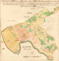
 Hornekarta1784.jpg 1,002 × 940; 264 KB
-
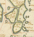
 Kungsgarden 1642 Tresk.png 748 × 786; 388 KB
-
 Lovolandet Gedda.jpg 740 × 800; 234 KB
-
 Tarv gst.jpg 670 × 580; 116 KB
-
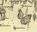
 Ytterhiske 1642.PNG 750 × 762; 1.22 MB


