Category:Old maps of Ulster
Jump to navigation
Jump to search
Subcategories
This category has only the following subcategory.
M
Media in category "Old maps of Ulster"
The following 15 files are in this category, out of 15 total.
-
 "Ultonia hibernis cuj-guilly, Anglis Ulster" (21637851783).jpg 3,761 × 3,108; 2.32 MB
-
 The Province Ulster described - Performed by John Speede - btv1b530569973 (1 of 2).jpg 6,688 × 5,240; 6.18 MB
-
 The Province Ulster described - Performed by John Speede - btv1b53225439w (2 of 3).jpg 6,163 × 4,654; 6.71 MB
-
-

-
 A plat of the lands belonging to the Company of Goldsmiths (27114684884).jpg 5,331 × 4,420; 8.94 MB
-
 Atlas Van der Hagen-KW1049B11 049-PROVINCIA VLITONIA The PROVINCIE of ULSTER.jpeg 5,500 × 4,313; 3.88 MB
-
 East part of Ulster RMG F2016.tiff 6,677 × 5,323; 101.69 MB
-
 East part of Ulster RMG L9622.jpg 1,280 × 1,013; 690 KB
-

-
 Provincia Ultoniae. The Province of Ulster - btv1b53056825x (1 of 2).jpg 6,320 × 5,096; 4.76 MB
-
 Provincia Vltoniae = The provincie of Vlster - CBT 6592161.jpg 5,704 × 4,486; 6.82 MB
-
 The Clothworkers Proporcion (27114684974).jpg 5,307 × 4,456; 9.7 MB
-
 The Fishmongers lands (27114684954).jpg 5,344 × 4,456; 9.01 MB
-
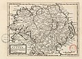
 Ulster JoanBlaeu 1659.jpg 720 × 595; 177 KB
.jpg)
.jpg)
.jpg)

.jpg)
.jpg)


_-_btv1b530612954.jpg)
.jpg)

.jpg)
.jpg)
