Category:Old maps of Uddevalla
Jump to navigation
Jump to search
Media in category "Old maps of Uddevalla"
The following 4 files are in this category, out of 4 total.
-
 18th century map of Uddevalla, Sweden.jpg 3,953 × 3,405; 777 KB
-

-
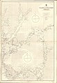 Admiralty Chart No 3644 Gullmar and Stig Fiords, Published 1907.jpg 11,112 × 16,242; 66.43 MB
-
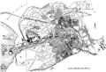 Karta över Uddevalla under tidigt 1900-tal.png 766 × 524; 53 KB

.jpg)

