Category:Old maps of Trier
Jump to navigation
Jump to search
Subcategories
This category has only the following subcategory.
M
Media in category "Old maps of Trier"
The following 38 files are in this category, out of 38 total.
-
 LASB K Hellwig 0881.jpg 2,868 × 2,232; 1.5 MB
-
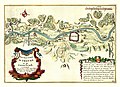
 Trier Beaulieu 1680.jpg 3,749 × 2,605; 10.52 MB
-
 De Fer Trier 1692.jpg 7,101 × 5,168; 30.14 MB
-
 Plan von Trier und Umgebung 1705.jpg 10,836 × 3,885; 21.63 MB
-
 LASB K Hellwig 0949.jpg 3,017 × 2,436; 9.64 MB
-
 Roscheiderhof-Karte-1820.jpg 1,684 × 1,716; 2.9 MB
-
 Hawich, Plan der Stadt Trier 1823.jpg 1,202 × 930; 889 KB
-
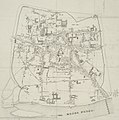 Büchel, Plan von Trier 1856.jpg 953 × 959; 524 KB
-
 Karte der Stadt Trier Mitte 19 Jh.jpg 1,897 × 1,914; 2.81 MB
-
 The earth and its inhabitants (1883) (20507804223).jpg 1,892 × 1,380; 1,007 KB
-
 Hees, Plan der Stadt Trier ca1890.jpg 4,674 × 4,901; 4.08 MB
-
 Plan-von-Trier.jpg 5,063 × 4,733; 3.8 MB
-
 Hees, Plan der Stadt Trier ca1896.jpg 3,987 × 5,094; 4.23 MB
-
 Bauklasseneinteilung-Stadt-Trier.jpg 2,062 × 3,000; 2.82 MB
-
 Lageplan-Dampfkraftwerk-Trier-Henney.jpg 2,401 × 1,798; 2.94 MB
-
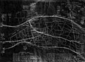
 Straßenbahnnetz-Trier-Henney.jpg 2,018 × 1,440; 2.15 MB
-
 Kaiser-Wilhelm-Brücke-Karte.jpg 1,431 × 790; 871 KB
-
 Map of Pfalzel, near Trier, Germany, in 1918 (IWM Q63724).png 661 × 810; 451 KB
-
-
 Meßtischblatt 6206 Pfalzel 1939.jpg 10,232 × 9,498; 17.24 MB
-
 Meßtischblatt-6205-Trier-1939.jpg 11,516 × 8,730; 16.18 MB
-
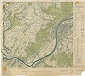
 Tarforst 1939.jpg 3,144 × 2,512; 2.04 MB
-
 Topographic Map of Trier - NARA - 100384427 (page 1).jpg 6,916 × 6,140; 4.98 MB
-
 Topographic Map of Trier with Defense Overprint - NARA - 100384430 (page 1).jpg 8,700 × 6,593; 6.07 MB
-
 Topographic Map of Trier with Defense Overprint - NARA - 100384430 (page 2).jpg 8,688 × 6,621; 6.3 MB
-
 Topographic Map of Trier with Defense Overprint - NARA - 100384430 (page 3).jpg 8,692 × 6,588; 6.05 MB
-
 Topographic map of Trier, Germany, February 1945 (100384427).png 4,150 × 3,684; 31.89 MB
-
 Karte von St. Maximin bei Trier.jpg 6,104 × 4,699; 22.17 MB
-
 L'abbaye de St. Martin pres Treves.jpg 3,698 × 2,803; 6.87 MB
-
 LASB K Hellwig 0740.jpg 3,156 × 2,490; 1.79 MB
-
 Meyer‘s Zeitungsatlas 059 – Rheinprovinz Niederrhein.jpg 7,302 × 6,231; 17.37 MB
-

-

-

-
 Schedel-trier2.jpg 2,248 × 1,988; 897 KB
-
 SebastianMünsterAusschnittRheinlaufkarteL1040596 (2).JPG 2,004 × 2,603; 2.1 MB
-

-
 Spruner-Menke Handatlas 1880 Karte 39 Nebenkarte 2.jpg 1,255 × 1,497; 134 KB


_(20507804223).jpg)


.png)
.jpg)


.jpg)
.jpg)
.jpg)
.jpg)
.png)


.jpg)
_Trier_an_der_Mosel,_die_haupt_u_residentz_statt_(..)_(titel_op_object),_RP-P-2018-1048.jpg)
,_RP-P-OB-83.204B.jpg)

.JPG)

