Category:Old maps of Tobolsk Governorate
Jump to navigation
Jump to search
Subcategories
This category has only the following subcategory.
O
Media in category "Old maps of Tobolsk Governorate"
The following 29 files are in this category, out of 29 total.
-
 1792. Карта Тобольского наместничества.jpg 7,288 × 5,984; 6.65 MB
-
 1800. Map of Tobol'sk Province (16 Districts) WDL129.png 1,259 × 1,024; 2.78 MB
-

-
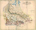
 1825. Tobolsk Governorate.jpg 4,773 × 8,852; 8.42 MB
-
 1826 Assheton Map of Russia in Asia - Geographicus - RussiaInAsia-assheton-1826.jpg 3,500 × 2,789; 2.67 MB
-
 1827 Finley Map of Russia in Asia - Geographicus - RussiaAsia-finley-1827.jpg 3,000 × 2,281; 1.95 MB
-
 1829. Тобольская губерния.jpg 4,891 × 8,923; 4.62 MB
-
 1859. Генеральная карта Азиатской России и Сибири (этнограф).jpg 34,000 × 26,750; 56.44 MB
-
 1860. Карта Западной Сибири.jpg 26,750 × 34,000; 50.82 MB
-
 1874. Карта Тобольской и Томской губерниям.jpg 12,391 × 10,495; 25.03 MB
-
 1889. Карта Тобольской губернии (масштаб 30).jpg 8,489 × 12,205; 20.37 MB
-
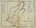
 1890. Tobolskaja gubernija.jpg 1,044 × 1,733; 281 KB
-
 1895. Карта азиатской России.jpg 12,058 × 10,049; 25.2 MB
-
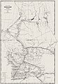
 1903. Карта Тобольской губернии.jpg 9,541 × 12,331; 17.81 MB
-
 1912. Карта Тобольской губернии.jpg 3,517 × 5,094; 4.87 MB
-
 1914. Карта Тобольской губернии.jpg 3,361 × 5,098; 4.33 MB
-

-
 Atlas of Russian Empire (1800). Tobolsk governorate.jpg 8,858 × 7,189; 11.22 MB
-
 Brockhaus and Efron Encyclopedic Dictionary b65 382-0.jpg 2,088 × 3,466; 2.49 MB
-
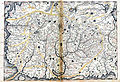
 Drawing Book of Siberia 21 map (cropped).jpeg 664 × 565; 258 KB
-
 Drawing Book of Siberia 21 map.jpeg 2,937 × 2,010; 3.49 MB
-
 Imperii Russici et Tartariae Universae Tabula.jpg 3,772 × 3,252; 6.31 MB
-
 Kitchen-21-Russia-Tobolsk-2809.jpg 2,560 × 1,920; 2.03 MB
-
 Map of Tobolsk Namestnichestvo 1792 (small atlas).jpg 2,643 × 2,211; 842 KB
-
 Map of Tobolsk Namestnichestvo 1796 (small atlas).jpg 2,882 × 2,421; 864 KB
-
 RussianEmpireMap1800-41-TobolskayaProvince.jpg 7,661 × 6,230; 10.3 MB
-
 Tobolskaia Governorate map (1808).jpg 1,146 × 912; 236 KB
-
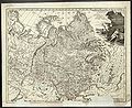
 Карта России 1745 года.png 3,137 × 1,795; 5.17 MB
-
 Карта Тобольского наместничества.jpg 4,859 × 3,989; 10.32 MB

_WDL129.png)


.jpg)


.jpg)


.jpg)
._Tobolsk_governorate.jpg)

.jpeg)


.jpg)
.jpg)

.jpg)

