Category:Old maps of Timișoara
Jump to navigation
Jump to search
Subcategories
This category has the following 2 subcategories, out of 2 total.
Media in category "Old maps of Timișoara"
The following 25 files are in this category, out of 25 total.
-
 1800 - Harta Banatului.jpg 12,795 × 11,583; 26.11 MB
-

-
 Tameswar - Clarke Edward Daniel - 1816.jpg 1,500 × 689; 243 KB
-
 1859 - Planul orasului Timisoara.jpg 5,216 × 4,289; 2.41 MB
-
 Timişoara BV043905302.jpg 14,408 × 11,102; 24.02 MB
-
 1938 map of Timisoara and surroundings.jpg 707 × 646; 123 KB
-
 1938 map of Timisoara.jpg 596 × 416; 92 KB
-

-
 Harta unirii piatra cubica.jpg 1,600 × 1,648; 2.08 MB
-
 Plan - von Temeswar - btv1b8493784k.jpg 6,972 × 10,288; 8.93 MB
-
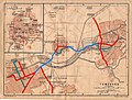
 Temesvár tervrajza 1893.jpg 801 × 493; 480 KB
-
 Temesvár város térképe, Trianon előtt.jpg 2,771 × 1,773; 3.33 MB
-

-

-
 Temeswarer District Josephinische Landaufnahme pg054 (cropped, Temeswar).jpg 4,000 × 2,400; 4.3 MB
-
 Temeswarer District Josephinische Landaufnahme pg054.jpg 8,356 × 5,755; 29.62 MB
-

-
 Timisoara 1900 II.JPG 566 × 427; 66 KB
-
 Timisoara 1905.jpg 600 × 447; 63 KB
-
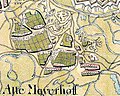 Timisoara, Maierele Vechi 1770.jpg 1,000 × 800; 424 KB
-
 Timisoara, Maierele Vechi 1850.jpg 1,000 × 800; 235 KB
-
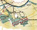
 Timisoara, zona sitului Fabric (I) 1780.jpg 300 × 360; 55 KB
-
 Timisoara, zona sitului Fabric (I) 1890.jpg 300 × 360; 55 KB
-
 Timişoara BV044698774.jpg 2,336 × 1,544; 855 KB
-
 Unirii Harta Pavaj.jpg 367 × 355; 49 KB


,_BI-B-FM-090-12.jpg)


_1(ichen)_u(und)_cathol(ischen)_Mayst._Armee_unter_dem_Com(m)ando_Ihro_Durchl(aucht)_des_Printzen_Eugeny_;_von_Savoy_den_1_ten_Sept._A...._-_btv1b530753939.jpg)
.jpg)


_1780.jpg)
_1890.jpg)


_(With_plates,_including_a_portrait.)%27_(11001509226).jpg)