Category:Old maps of Thessaloniki
Jump to navigation
Jump to search
Media in category "Old maps of Thessaloniki"
The following 14 files are in this category, out of 14 total.
-
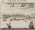
Salonichi - Dapper Olfert - 1688.jpg 800 × 700; 247 KB
-
Thermaikos Gulf chart.jpg 1,188 × 867; 181 KB
-
Plan of Thessalonica - Texier Charles - 1864.jpg 1,500 × 1,113; 485 KB
-
Thessaloniki map 1882.jpg 978 × 1,156; 339 KB
-
Saloniki and Environs 1890.jpg 3,480 × 4,520; 3.92 MB
-
Gemedjii map.jpg 595 × 395; 69 KB
-
Salonika from Turkey 1 to 250,000.jpg 8,749 × 6,779; 8.73 MB
-
LPDF 63 5 carte de Salonique.jpg 721 × 466; 162 KB
-
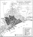
Thessaloniki Fire 1917 Map.jpg 685 × 761; 157 KB
-
ThessaloniqueHébrard.PNG 4,888 × 3,498; 22.8 MB
-
1917mapSalonica.jpeg 602 × 441; 102 KB
-
Carte de salonique par Hebrart.jpg 1,221 × 912; 411 KB
-
Salonik Map from Türkei und Griechenland, Meyers Reisebücher, Leipzig, 1892.jpg 1,000 × 643; 201 KB
-
Thessaloniki in 1688.png 495 × 386; 395 KB


