Category:Old maps of Teller County, Colorado
Jump to navigation
Jump to search
Subcategories
This category has the following 2 subcategories, out of 2 total.
Media in category "Old maps of Teller County, Colorado"
The following 8 files are in this category, out of 8 total.
-
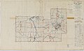
 106 of '(Articles on mining and geology reprinted from periodicals.)' (11209228373).jpg 1,431 × 2,177; 787 KB
-
 Cripple Creek mining district, the great gold camp of Colorado LOC 81691929.jpg 8,384 × 11,632; 25.07 MB
-
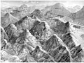
 Cripple Creek, 1896. - DPLA - 5b344d0aaf62d474a029a50f145a1624.jpg 7,000 × 5,231; 6.01 MB
-
 Cripple Creek, 1896. LOC 75693128.jpg 11,232 × 8,400; 20.94 MB
-
 Cripple Creek, 1896. LOC 75693128.tif 11,232 × 8,400; 269.93 MB
-
-

-
%27_(11209228373).jpg)


_-_Teller_County_-_Teller_County_-_ED_60-1_to_15_-_DPLA_-_225d5d46a4c4a877206e893739abd535.jpg)

