Category:Old maps of Taoyuan
Jump to navigation
Jump to search
中文(臺灣):桃園市的古地圖
Media in category "Old maps of Taoyuan"
The following 20 files are in this category, out of 20 total.
-
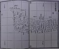
 Taoyuan 1747.jpg 2,042 × 2,090; 1.01 MB
-
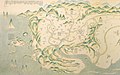
 01淡水廳全圖.jpg 3,664 × 2,918; 3.21 MB
-
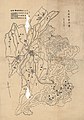
 02淡水廳分圖一.jpg 3,336 × 2,724; 2.74 MB
-
 03淡水廳分圖二.jpg 3,459 × 2,784; 2.68 MB
-
 07淡水廳沿山各隘圖二.jpg 3,646 × 3,004; 2.93 MB
-
 09淡水廳沿海礁砂形勢圖二.jpg 3,686 × 3,092; 3.2 MB
-
 1897Yongan Fishing Harbor.png 799 × 451; 274 KB
-
 1904fuyuan.png 690 × 629; 377 KB
-
 1904gaoshanding.png 799 × 610; 492 KB
-
 1904台灣堡圖.png 656 × 600; 512 KB
-
 Txu-oclc-6594702.jpg 3,975 × 3,209; 3.05 MB
-
 古地圖展-台灣地圖a.jpg 1,920 × 1,206; 634 KB
-
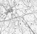
 台灣堡圖(中壢老街、新街).PNG 910 × 646; 636 KB
-
 大園庄管內圖.jpg 2,081 × 3,087; 2.05 MB
-
 大溪街地圖.jpg 1,191 × 834; 704 KB
-
 大溪街管內圖.jpg 2,918 × 4,179; 5.92 MB
-
 桃園大圳工事平面圖.jpg 1,363 × 1,074; 376 KB
-
 桃園廳管內圖.jpg 2,085 × 3,094; 1.98 MB
-
 桃園水利組合灌區圖.jpg 3,500 × 1,966; 1.04 MB
-
 蘆竹庄管內圖.jpg 4,135 × 5,094; 4.8 MB


.PNG)


