Category:Old maps of Strafford County, New Hampshire
Jump to navigation
Jump to search
Subcategories
This category has the following 5 subcategories, out of 5 total.
S
Media in category "Old maps of Strafford County, New Hampshire"
The following 18 files are in this category, out of 18 total.
-

-

-

-
 Salmon Falls, Strafford Co., New Hampshire 1877. LOC 73694812.jpg 4,280 × 3,528; 3.66 MB
-
 Rochester, N.H. (2675836602).jpg 2,000 × 1,457; 2.52 MB
-
 Rochester, N.H., Gonic and East-Rochester, 1884. LOC 75694700.jpg 7,232 × 5,600; 6.86 MB
-
 Rochester, N.H., Gonic and East-Rochester, 1884. LOC 75694700.tif 7,232 × 5,600; 115.87 MB
-
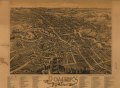
 Dover, Stafford County, New Hampshire 1888. LOC 74693164.jpg 9,792 × 7,184; 12.29 MB
-
 Dover, Stafford County, New Hampshire 1888. LOC 74693164.tif 9,792 × 7,184; 201.26 MB
-
 Milton, N.H. (2675008637).jpg 2,000 × 1,283; 1.66 MB
-
 Milton, N.H., 1888 LOC 79693221.jpg 7,920 × 4,640; 5.75 MB
-
 Milton, N.H., 1888 LOC 79693221.tif 7,920 × 4,640; 105.14 MB
-
 Strafford County, New Hampshire LOC 81690023.jpg 3,832 × 6,107; 2.42 MB
-
 Strafford County, New Hampshire LOC 81690023.tif 3,832 × 6,107; 66.95 MB
-
 Strafford County, New Hampshire LOC 81690122.jpg 7,196 × 7,234; 4.22 MB
-
 Strafford County, New Hampshire LOC 81690122.tif 7,196 × 7,234; 148.93 MB
-

-


.jpg)


.jpg)


