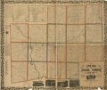
Category:Old maps of Stark County, Ohio
Jump to navigation
Jump to search
Subcategories
This category has the following 5 subcategories, out of 5 total.
A
C
L
M
Media in category "Old maps of Stark County, Ohio"
The following 4 files are in this category, out of 4 total.
-
New map of Stark County, Ohio LOC 2012592392.jpg 15,222 × 12,757; 25.41 MB
-
New map of Stark County, Ohio LOC 2012592392.tif 15,222 × 12,757; 555.57 MB
-
New map of Stark County, Ohio LOC 2012592393.jpg 15,750 × 13,148; 26.9 MB
-
New map of Stark County, Ohio LOC 2012592393.tif 15,750 × 13,148; 592.46 MB


