Category:Old maps of St. Louis, Missouri
Jump to navigation
Jump to search
Subcategories
This category has the following 2 subcategories, out of 2 total.
Media in category "Old maps of St. Louis, Missouri"
The following 31 files are in this category, out of 31 total.
-

-
 (St. Louis. LOC 75694664.jpg 3,152 × 2,912; 1.06 MB
-
 (St. Louis. LOC 75694664.tif 3,152 × 2,912; 26.26 MB
-
-
 1852 Colton Sectional Pocket Map of Illinois - Geographicus - Illinois-colton-1852.jpg 4,015 × 6,000; 6.62 MB
-

-
 1856 chicago st. louis.jpg 5,152 × 4,316; 6.5 MB
-

-
 Coltons plans of U.S. harbors (St Louis).jpg 285 × 324; 143 KB
-

-

-

-

-
 Cheltenham Fireclay Works.tiff 2,203 × 1,126; 9.47 MB
-
 EB9 St Louis - central layout.jpg 830 × 1,473; 756 KB
-
 EB9 St Louis - city and vicinity.jpg 613 × 869; 222 KB
-
 Map of Trail P5310482.jpg 2,629 × 1,000; 295 KB
-
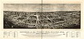 Panorama of the World's Fair, St Louis, 1904. LOC 97683596.jpg 12,512 × 5,824; 11.42 MB
-
 Partition of land of Auguste Chouteau. In U.S. Survey no. 363.jpg 7,982 × 4,262; 9.88 MB
-
 Pictorial St. Louis Pl. 97.tiff 5,856 × 4,032; 67.56 MB
-
 Plan of the city of St. Louis, Mo. (Detail showing Chouteau's Pond.).jpg 5,792 × 8,688; 15.1 MB
-
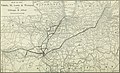
 Rail Bridges in St. Louis and Surrounding Area 1910.jpg 1,757 × 2,253; 2.27 MB
-
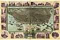 Saint Louis in 1896. LOC 75694662.jpg 12,256 × 8,160; 22.31 MB
-
 SaintLouis1790s.jpg 546 × 406; 60 KB
-
 St Louis Birdseye Map 1896.jpg 10,753 × 6,999; 14.21 MB
-
 St Louis, Missouri 1955 Yellow Book.jpg 800 × 639; 180 KB
-
 Stlouis1780.jpeg 1,107 × 699; 205 KB
-
 Survey of Upper Louisiana District of St. Louis of Illinois, 1803.jpg 8,768 × 5,400; 9.03 MB
-
 The Commercial and financial chronicle (1910) (14761136641).jpg 4,212 × 2,560; 2.97 MB
-
 The panorama of St. Louis. LOC 75694660.jpg 8,096 × 5,664; 5.8 MB
-
 TowerGrovePark-StLouis-MO-1883-PlanOfTGP-HABS-HAER-099057pu.jpg 4,462 × 1,538; 1.4 MB
.jpg)


.jpg)
.jpg)
.jpg)
.jpg)
%27_(11006405145).jpg)
.jpg)


.jpg)


_(14761136641).jpg)
