Category:Old maps of Semarang
Jump to navigation
Jump to search
Media in category "Old maps of Semarang"
The following 16 files are in this category, out of 16 total.
-
 AMH-5582-NA Map of Semarang.jpg 2,400 × 1,080; 341 KB
-
 AMH-5472-NA Map of Semarang and environs.jpg 1,670 × 2,400; 586 KB
-
 AMH-7242-KB Map showing the road between Samarang and Cartasoera.jpg 1,454 × 2,400; 765 KB
-
 AMH-5583-NA Map of Semarang.jpg 2,400 × 1,701; 618 KB
-
 AMH-5584-NA Map of Samarang.jpg 1,574 × 2,400; 595 KB
-
 AMH-5585-NA Plan for the construction of batteries near Semarang.jpg 2,400 × 1,615; 635 KB
-
 AMH-5586-NA Map of Samarang.jpg 2,400 × 2,110; 543 KB
-
 AMH-5587-NA Map of Samarang.jpg 2,400 × 1,602; 819 KB
-
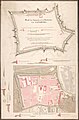
 AMH-4657-NA Map of the fort at Samarang.jpg 2,400 × 2,248; 663 KB
-
 AMH-4658-NA Map of the fort at Samarang.jpg 2,400 × 2,073; 734 KB
-
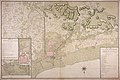
 AMH-4659-NA Map of Semarang and environs.jpg 2,400 × 2,084; 975 KB
-
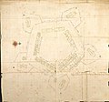
 AMH-4662-NA Map for the construction of a citadel to the south of Samarang.jpg 2,400 × 1,934; 626 KB
-

-
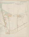 KAARTEN SGD - Verbetering der Semarangsche haven-inrichtingen.jpeg 2,786 × 3,471; 835 KB
-
 Semarang, 1741.jpg 4,800 × 4,199; 7.39 MB
-
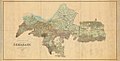 Topography chart semarang residency.jpg 1,024 × 519; 81 KB


