Category:Old maps of Saskatchewan
Jump to navigation
Jump to search
Provinces and territories of Canada: Alberta · British Columbia · Manitoba · New Brunswick · Newfoundland and Labrador · Nova Scotia · Ontario · Prince Edward Island · Quebec · Saskatchewan · Northwest Territories · Nunavut · Yukon
Subcategories
This category has only the following subcategory.
1
Media in category "Old maps of Saskatchewan"
The following 10 files are in this category, out of 10 total.
-

-

-
 Batoche Battle Field 1885.jpg 900 × 668; 717 KB
-
 North West Territories. (IA bp 3134).pdf 2,964 × 1,968, 2 pages; 3.88 MB
-

-
 EB1911 Saskatchewan.jpg 855 × 1,745; 636 KB
-
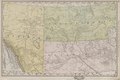
 Manitoba and Northwest Territories (1900).jpg 3,510 × 2,550; 9.76 MB
-
 Northern Pacific Railroad map circa 1900 Assiniboia.png 2,060 × 1,032; 2.96 MB
-

-
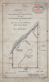 Young Chippewayan 5830CLSRSK.png 782 × 1,302; 1.49 MB
%27_(11166955235).jpg)


_(1901)_(14782495604).jpg)

.jpg)

