Category:Old maps of San Francisco Bay
Jump to navigation
Jump to search
Media in category "Old maps of San Francisco Bay"
The following 26 files are in this category, out of 26 total.
-
 1781 Cañizares Map of San Francisco Bay (cropped).jpg 1,500 × 2,400; 536 KB
-
 1781 Cañizares Map of San Francisco Bay.pdf 850 × 1,300; 5.03 MB
-

-

-

-

-

-

-
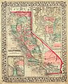 1867 California.jpg 3,375 × 4,185; 3.44 MB
-

-

-
 Admiralty Chart No 229 Point Pinos to Bodega Head, Published 1868, Large Corrections 1959.jpg 11,274 × 16,460; 59.85 MB
-
 Admiralty Chart No 2530 Diego Bay to Cape Mendocino, Published 1858.jpg 8,091 × 11,856; 28.54 MB
-

-
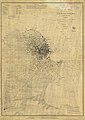
 Bayofsanfrancicsco1873.jpg 8,240 × 10,736; 14.19 MB
-
 Brockhaus' Konversations-Lexikon (1892) (14784225992).jpg 1,654 × 2,440; 804 KB
-
 California Delta Map 1848?.tiff 877 × 776; 2 MB
-
 D356- N° 489. Un port de haute mer - San Francisco. - Liv4-Ch02.png 1,446 × 1,332; 147 KB
-

-

-
 Lange diercke sachsen vereinigte staaten san francisco.jpg 965 × 924; 493 KB
-
 NIE 1905 San Francisco - map.jpg 1,574 × 2,474; 1.59 MB
-
 Revere & Beechey Harbour of San Francisco California 1846-1849 UTA.jpg 2,246 × 2,868; 1.45 MB
-
 San Francisco - 1853 - 001.jpg 2,583 × 3,635; 9.93 MB
-
 SAN FRANCISCO UND UMGEBUNG.png 2,000 × 2,961; 12.32 MB
-

.jpg)


%27_(11293637914).jpg)
.jpg)


_(14784225992).jpg)


_(14781989482).jpg)