Category:Old maps of San Antonio, Texas
Jump to navigation
Jump to search
Media in category "Old maps of San Antonio, Texas"
The following 35 files are in this category, out of 35 total.
-
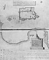 AlamoplanF0385.jpg 600 × 739; 111 KB
-
 Old map-San Antonio-1873.jpg 8,889 × 7,178; 15.55 MB
-
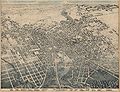 San Antonio, Texas in 1886.jpg 15,037 × 11,525; 69.58 MB
-

-

-
-

-
 Rullman's map of the city of San Antonio LOC 2009583814.jpg 12,818 × 14,324; 22.93 MB
-
 Rullman's map of the city of San Antonio LOC 2009583814.tif 12,818 × 14,324; 525.3 MB
-
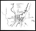
 San Antonio Light Bird's Eye View Map of San Antonio, Texas December 1891 UTA.jpg 3,150 × 2,136; 3.32 MB
-
 Siege of Bexar.jpg 930 × 805; 76 KB
-

-

-

-

-

-

-
-

-

-

-
-

-

-

-

-
-

-
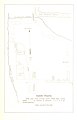
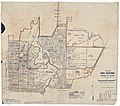
 San Antonio, Texas 1955 Yellow Book.jpg 800 × 824; 227 KB
-

-

-

-

-

-


%27_(11202784206).jpg)
%27_(11207287404).jpg)
%27_(11207325135).jpg)
%27_(11202546243).jpg)


.jpg)
.jpg)
.jpg)
.jpg)
_-_Bexar_County_-_San_Antonio_-_ED_265-1_to_462_-_NARA_-_44271092_(page_1).jpg)
_-_Bexar_County_-_San_Antonio_-_ED_265-1_to_462_-_NARA_-_44271092_(page_2).jpg)
_-_Bexar_County_-_San_Antonio_-_ED_265-1_to_462_-_NARA_-_44271092_(page_3).jpg)
_-_Bexar_County_-_San_Antonio_-_ED_265-1_to_462_-_NARA_-_44271092_(page_4).jpg)
_-_Bexar_County_-_San_Antonio_-_ED_265-1_to_462_-_NARA_-_44271092_(page_5).jpg)
_-_Bexar_County_-_San_Antonio_-_ED_265-1_to_462_-_NARA_-_44271092_(page_6).jpg)
_-_Bexar_County_-_San_Antonio_-_ED_265-1_to_462_-_NARA_-_44271092_(page_7).jpg)
_-_Bexar_County_-_San_Antonio_Vicinity_-_ED_15-20,_15-32_to_40,_15-50_to_54,_15-53,_15-56_to_57,_15-59_to_73,_15-79_to_87,_15-91,_15-98_to_99,_15-101_-_NARA_-_44271100_(page_1).jpg)
_-_Bexar_County_-_San_Antonio_Vicinity_-_ED_15-20,_15-32_to_40,_15-50_to_54,_15-53,_15-56_to_57,_15-59_to_73,_15-79_to_87,_15-91,_15-98_to_99,_15-101_-_NARA_-_44271100_(page_2).jpg)
_-_Bexar_County_-_San_Antonio_Vicinity_-_ED_15-20,_15-32_to_40,_15-50_to_54,_15-53,_15-56_to_57,_15-59_to_73,_15-79_to_87,_15-91,_15-98_to_99,_15-101_-_NARA_-_44271100_(page_3).jpg)
_-_Bexar_County_-_San_Antonio_Vicinity_-_ED_15-20,_15-32_to_40,_15-50_to_54,_15-53,_15-56_to_57,_15-59_to_73,_15-79_to_87,_15-91,_15-98_to_99,_15-101_-_NARA_-_44271100_(page_4).jpg)
_-_Bexar_County_-_San_Antonio_Vicinity_-_ED_15-20,_15-32_to_40,_15-50_to_54,_15-53,_15-56_to_57,_15-59_to_73,_15-79_to_87,_15-91,_15-98_to_99,_15-101_-_NARA_-_44271100_(page_5).jpg)
_-_Bexar_County_-_San_Antonio_Vicinity_-_ED_15-20,_15-32_to_40,_15-50_to_54,_15-53,_15-56_to_57,_15-59_to_73,_15-79_to_87,_15-91,_15-98_to_99,_15-101_-_NARA_-_44271100_(page_6).jpg)

.png)
.png)
.png)