Category:Old maps of Saint-Omer
Jump to navigation
Jump to search
Subcategories
This category has the following 3 subcategories, out of 3 total.
M
Media in category "Old maps of Saint-Omer"
The following 10 files are in this category, out of 10 total.
-
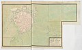 Plan de Saint-Omer 1693.jpg 8,137 × 5,035; 4.11 MB
-
 Atlas de Wit 1698-pl086-Saint Omer-KB PPN 145205088.jpg 2,000 × 1,649; 1.51 MB
-

-
 Cavalier.Saint.Omer.png 544 × 465; 38 KB
-
 Plan de 1929 de la ville de Saint-Omer.jpg 2,395 × 1,840; 1.43 MB
-
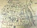
 Saint Omer.jpg 392 × 264; 52 KB
-
 Saint-Omer - btv1b8443929p.jpg 11,016 × 8,113; 10.83 MB
-
 Saint-Omer - btv1b8468882t.jpg 4,426 × 6,416; 3.42 MB
-
 Saint-Omer en Artois avec les forts des environs - btv1b8439873b.jpg 8,491 × 7,114; 10.56 MB
-
 Saint-Omer, ville forte des Pays-Bas dans le comté d'Artois... - btv1b8440915q.jpg 5,292 × 3,993; 3.05 MB


.jpeg)


