Category:Old maps of Södermanland County
Jump to navigation
Jump to search
Media in category "Old maps of Södermanland County"
The following 16 files are in this category, out of 16 total.
-
 1869 Salem.jpg 1,605 × 1,223; 498 KB
-

-
 Kungsboken-karta-sodermanland.jpg 13,256 × 6,931; 8.78 MB
-
 Landskapskarta Södermanland.png 2,731 × 2,057; 10.23 MB
-
 Ljunggren Eskilstuna.png 4,310 × 5,510; 22.05 MB
-
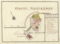
 Ljunggren Mariefred detaljkarta (cropped).png 523 × 677; 231 KB
-
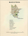
 Ljunggren Mariefred.png 2,205 × 2,755; 5.47 MB
-
 Ljunggren Nyköping.png 2,055 × 2,705; 6.7 MB
-
 Ljunggren Strengnäs.png 2,205 × 2,755; 6.19 MB
-
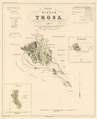 Ljunggren Trosa.png 1,955 × 2,405; 2.94 MB
-
 Wiblingen Malmköping.png 2,277 × 1,773; 3.89 MB
-
 Wiblingen Mariefred.png 2,479 × 1,822; 4.61 MB
-
 Wiblingen Nyköping.png 2,615 × 2,205; 6.7 MB
-
 Wiblingen Strängnäs.png 2,291 × 1,834; 4.41 MB
-
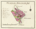
 Wiblingen Torshälla.png 2,277 × 1,798; 4.04 MB
-
 Wiblingen Trosa.png 2,325 × 1,738; 3.76 MB

.jpg)


.png)


