Category:Old maps of Quito
Jump to navigation
Jump to search
Subcategories
This category has the following 3 subcategories, out of 3 total.
- 17th-century maps of Quito (2 F)
- 18th-century maps of Quito (11 F)
- 19th-century maps of Quito (8 F)
Media in category "Old maps of Quito"
The following 20 files are in this category, out of 20 total.
-
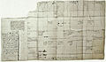
 "Pl. XXI A-B-C" (19864899908).jpg 12,304 × 2,971; 6.46 MB
-
 Neu Germania pg169 11211535785.jpg 3,661 × 2,754; 2.42 MB
-
 2e. feuille Suite de la province de Quito auPerou - (par J.N. Bellin) - btv1b85965093.jpg 6,144 × 4,209; 4.98 MB
-
 3e. feuille Suite de la province de Quito auPerou - (par J.N. Bellin) - btv1b8596510r.jpg 6,010 × 3,419; 3.87 MB
-
 Carta De La Provincia de Quito Y De Sus Adjacentes.jpg 9,930 × 13,798; 19.96 MB
-
 Casa Abierta- Cartografía, documentos y libros antiguos (4520737973).jpg 3,532 × 2,240; 6.9 MB
-
 First graphic of the layout of Colonial Quito.jpg 1,424 × 835; 809 KB
-
 Historic Center of Quito - World Heritage Site by UNESCO - Photo 283.JPG 3,456 × 4,608; 3.97 MB
-
 Historic Center of Quito - World Heritage Site by UNESCO - Photo 284.JPG 4,608 × 3,456; 3.96 MB
-
 Iere feuille Province de Quito au Pérou - (par J.N. Bellin) - btv1b8596508p.jpg 6,161 × 4,032; 4.17 MB
-
 Mapa Hipotético del Reino de Quito - AHG.jpg 5,013 × 6,975; 9.87 MB
-
 Mapaquito1922.jpg 1,500 × 653; 1.4 MB
-
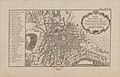
 Plan de la ville de Quito - par Albert Salazza... - btv1b53062336t.jpg 9,893 × 7,374; 10.95 MB
-
-

-
 Plano de la ciudad de Quito - lith. de P. Bineteau ; gravé par L. Petit - btv1b53087689q.jpg 8,704 × 6,744; 5.13 MB
-
 Quito 011.jpg 480 × 341; 82 KB
-
 Relacion historica del viage a la America meridional (26791032169).jpg 4,191 × 2,875; 3.37 MB
-
 Relacion historica del viage a la America meridional (38567291301).jpg 4,517 × 2,903; 3.19 MB
-
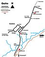 Tranvías de Quito.jpg 617 × 792; 94 KB

_-_btv1b85965093.jpg)
_-_btv1b8596510r.jpg)

.jpg)


_-_btv1b8596508p.jpg)


_-_btv1b8596512k.jpg)


.jpg)
.jpg)

.jpg)