Category:Old maps of Quedlinburg
Jump to navigation
Jump to search
Subcategories
This category has only the following subcategory.
Media in category "Old maps of Quedlinburg"
The following 12 files are in this category, out of 12 total.
-
 Ausschnitt Karte.png 1,285 × 1,250; 3.21 MB
-
 Fürstentum Halberstadt-Abtei Quedlinburg.jpg 2,940 × 1,912; 3.83 MB
-

-
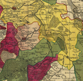
 Geschichtliche Karte des ehemaligen Reichsstiftes Quedlinburg.jpg 2,596 × 1,986; 1.38 MB
-
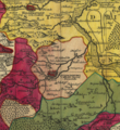
 Geschichtliche Karte von Quedlinburg u. Ditfurt.jpg 3,840 × 2,160; 3.43 MB
-
 Map of Quedlinburg (1910).jpg 1,167 × 791; 352 KB
-
 Quedlinburg (Merian).jpg 1,604 × 540; 236 KB
-
 Quedlinburg Abbey territory, mid-18th century.png 847 × 921; 1.9 MB
-
 Quedlinburg Voigt 1782.jpg 1,643 × 1,287; 500 KB
-
 Quedlinburg-1647-Merian.jpg 3,200 × 1,094; 815 KB
-
 Reilly 377.jpg 1,579 × 1,302; 501 KB
-
 Stadtplan von Quedlinburg.png 1,679 × 1,112; 3.94 MB


.jpg)


.jpg)